

Images & Animations
-
Credit
<P> Image provided by the USGS EROS Data Center Satellite Systems Branch.</P> <P> This image is part of the ongoing Landsat Earth as Art series. </P> <P> <IMG SRC="/Newsroom/NewImages/Images/usgs_logo.gif" WIDTH=167 HEIGHT=62 HSPACE=0 VSPACE=0 BORDER=0> </P>
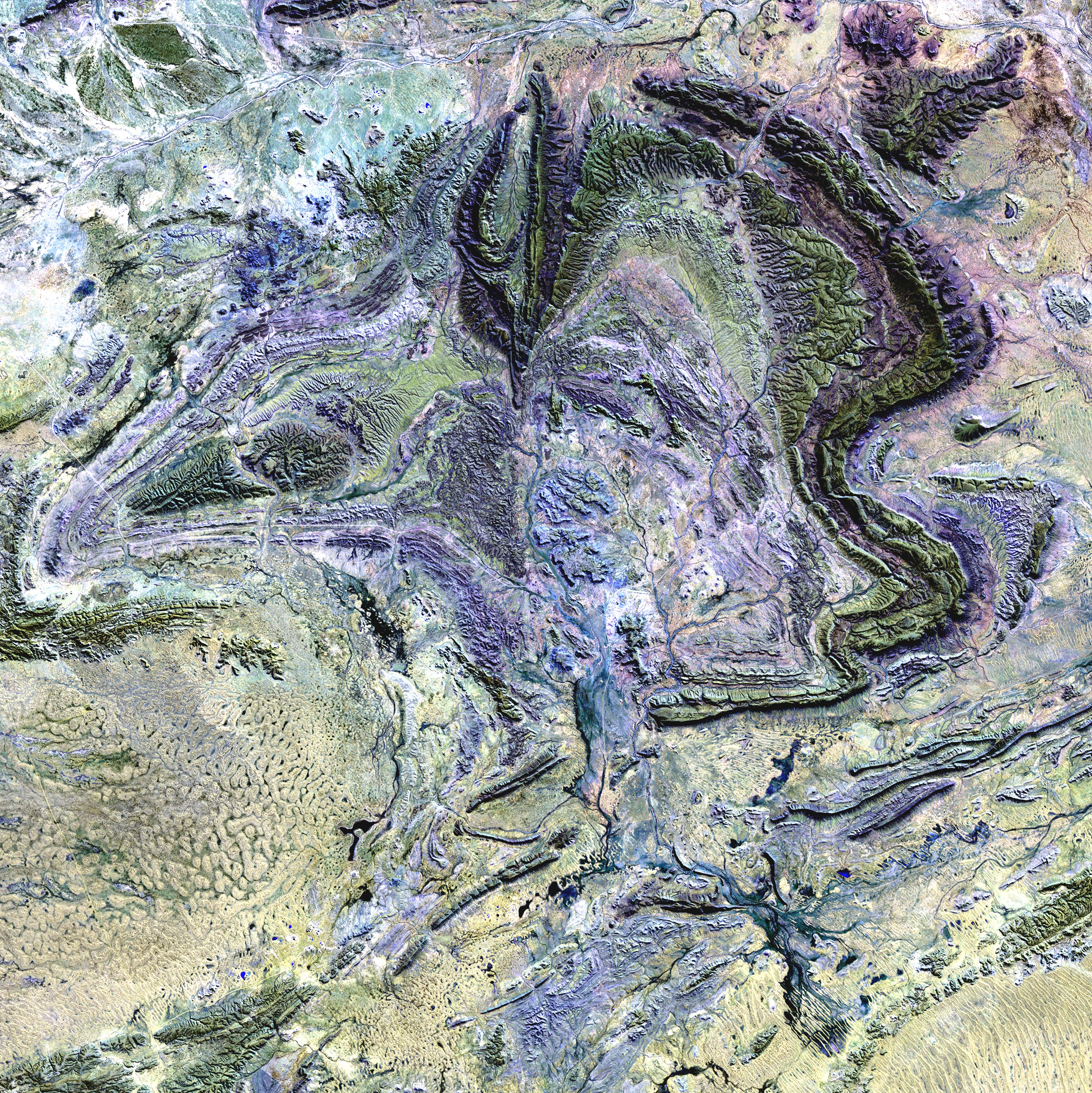
The MacDonnell Ranges are a band of mountains spanning Australia's arid interior. Only a portion of the Ranges can be seen in this image.
This image was acquired by Landsat 7's Enhanced Thematic Mapper plus (ETM+) sensor on August 1, 2000. This is a false-color composite image made using shortwave infrared, infrared, and green wavelengths. The image has also been sharpened using the sensor's panchromatic band.
Metadata
-
Sensor
Landsat 7/ETM+ -
Visualization Date
2002-08-26