Urban Signatures: Temperature (WMS)
|
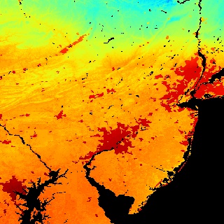
Big cities influence the environment around them. For example, urban areas are typically warmer than their surroundings. Cities are strikingly visible in computer models that simulate the Earth's land surface. This visualization shows average surface temperature predicted by the Land Information System (LIS) for a day in June 2001. Only part of the global computation is shown, focusing on the highly urbanized northeast corridor in the United States, including the cities of Boston, New York, Philadelphia, Baltimore, and Washington.
|
|
|
|
This image shows average surface temperatures
predicted by LIS for 2001/06/11. Temperatures range from 9 C to
35 C (48F to 95F), with the hottest areas being red and dark
red. Temperatures are generally cooler farther north and at
higher elevations. The urban areas stand out very distinctly
against their surroundings.
Available formats:
1000 x 1000
PNG
454 KB
320 x 320
JPEG
63 KB
80 x 40
PNG
5 KB
160 x 80
PNG
20 KB
|
|
This product is available through our Web Map Service.
Click here to learn more.
|
|
|
|
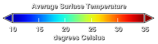
Temperature color bar ranging from 10 C (50 F) to 35 C (95 F).
Available formats:
320 x 90
PNG
10 KB
|
|
|
Back to Top
|


