Description of Maps
Description of Maps
|
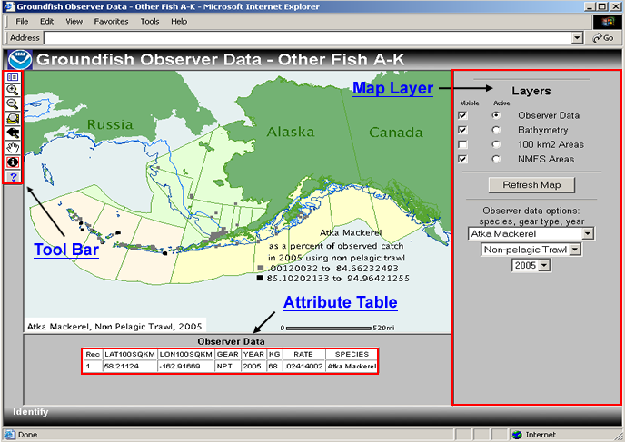
| Click on one of the highlighted areas of the map or its title for further instructions on its usage. |
|
|
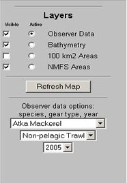
| Map Layer Descriptions The layer list allows users to select which map layers are visible and active. The three drop down lists allow users to determine what information they would like to display by choosing the species, gear type, and year. The "Refresh Map" button updates the map after changes have been made to the layers or the selection criteria.
|
 |
||||||||||||||||||||||||||||
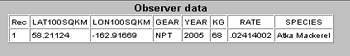
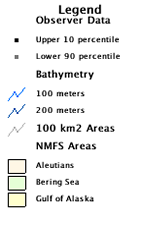
| Map Legend Description The map legend identifies the different types of objects that are displayed on the map.
|
 |
||||||||||||||||||||||||||||
| Tool Bar Descriptions
The tools of the tool bar are used to navigate around the map and select objects with the Identify tool. |
|||||||||||||||||||||||||||||
|
|||||||||||||||||||||||||||||
| ||||||||||||||||||
|