![](https://webarchive.library.unt.edu/eot2008/20090510193159im_/http://www.bts.gov/images/spacer.gif) |
Figure 6. Top 20 NAFTA Land Ports: 1995 and 2000
(Percentage of value)
Excel | CSV
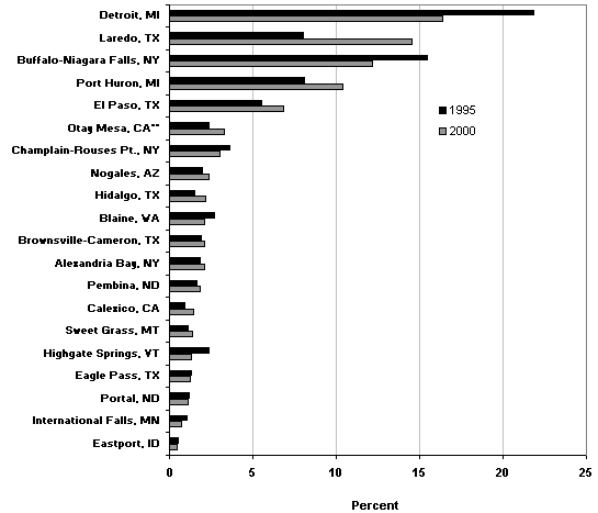
**1995 data for Otay Mesa, CA, include traffic crossing the border at San Ysidro, CA, which has since been closed to truck traffic.
NOTE: Land trade includes truck, rail, pipeline, and miscellaneous and unknown modes.
SOURCES: U.S. Department of Transportation, Bureau of Transportation Statistics, Transborder Surface Freight Data, 1995 and 2000.
|
|
![](https://webarchive.library.unt.edu/eot2008/20090510193159im_/http://www.bts.gov/images/spacer.gif) |