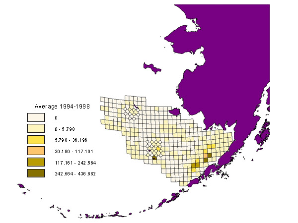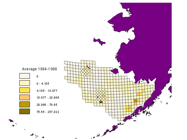
| Habitat Areas of Particular Concern (HAPC) | Eastern Bering Sea |
Sponges
Distribution and Abundance Maps (kg/hectare)
(Data derived from standard NMFS
groundfish/crab trawl surveys where
catches of noncommercial species are also enumerated and weighed.)
![]() indicates standard areas of higher density sampling relative to the
20-nmi sampling grid.
indicates standard areas of higher density sampling relative to the
20-nmi sampling grid.
![]() indicate standard areas of higher density sampling relative to the
20-nmi sampling grid.
indicate standard areas of higher density sampling relative to the
20-nmi sampling grid.