Skip all navigation and jump to content Jump to site navigation Jump to section navigation.
NASA Logo - Goddard Space Flight Center + Visit NASA.gov
HOME PROJECTS RESOURCES SEARCH MAP

+ Advanced Search
Home
Home
View Most Recently Released Imagery
View Gallery of Imagery: A topical collection of SVS Imagery
Search Imagery by the keywords assigned to it
Search Imagery by the instruments that supplied data for a visualization product
Search Imagery by the series of visualizations that have been produced
Search Imagery by the scientist providing the data used in a visualization product
Search Imagery by the animator that created the product
Search Imagery by the identification number assigned to the visualization product
See other search options
Learn about the SVS Image Server
  + About the Server
  + Animation List
  + How to Use the Server


  + RSS Feeds
blank image

Earth Views


Image for Earth Views
Movie   ID   Title
This visualization is of Orlando, Florida   1234   
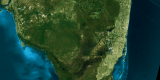
Zoom Down to Orlando, Florida
Zooming down to Miami, Florida   1233   Landsat 7 Fly Over of Miami, Florida
Viewing Earth from space, the Landsat 7 satellite takes images of
the Earth, which allows us to look at land changes such as; urban growth, deforestation,
and overall changes in the Earth itself. Here is a Landsat 7 image of Tampa, Florida.   1232   Landsat 7 Fly Over of Tampa, Florida
Landsat 7 image of Chile. Zooming down and seeing
the volcanos.   1231   Landsat 7 Fly Over of Chile
Flying over the Channel Islands off the coast of Santa
Barbara, Ca. Using Landsat 7 data (taken in July 28, 1999), and drapping it on
to USGS Elevation data. We are able to fly in a 3D world and view the mountains
and valley.   1230   Full Flyover Santa Barbara
Flying down US 101 in Santa Barbara to Los Angeles Ca.
Using Landsat 7 data, we are albe to add USGS elevation data, which helps us see
in 3D the coast of California.   1229   Coastal Fly Down from Santa Barbara 2
Flying up the California coast, heading north towards Santa
Barbara, Ca.   1225   Coastal Fly Down from Los Angeles to Santa Barbara
Zooming down to Anaheim, CA.   1224   Zoom Down to Anaheim, CA
Using Landsat data, scientist are able to see
Urban growth, and the deforestation of old tree growth.  They are also able
to see the large Metro areas.   1223   Zoom Down to Seattle, Washington
Flying down the coast of California from Santa Barbara to
Los Angeles. Using Landsat 7 dataset of California and USGS elevation data, we
are albe to fly in 3D space and view this beautiful area.   1222   Coastal Fly Down from Santa Barbara to Los Angeles
Zooming down to Las Vegas From Landsat imagery acquired July 26, 1999   1221   Zoom to Las Vegas from Landsat
Zooming down to Santa Barbara, Ca. With the help of
3D space, we can see this beautiful image.   1220   Zoom Down to Santa Barbara, CA
With the help of Landsat 7 and USGS elevation data
we are able to fly around or zoom down to Chile.   1219   Zoom Down and Fly Around a Landsat 7 Dataset of Chile
Using Landsat data and USGS elevation data, this
animation takes you to Mt. Rainer, Washington without leaving your house.   1216   Fly Around Mt. Rainier (Blue Sky)
Using Landsat data and USGS elevation data, this
animation takes you to Mt. Rainer, Washington without leaving your house.   1215   Fly Around Mt. Rainier (Black Sky)
Zooming down to Los Angeles, Ca.  Using Landsat 7 data
sets and USGS elevation data.   1214   Zoom down to Los Angeles, CA


Back to Top

USA.gov logo - the U.S. Government's official Web portal. + Privacy Policy and Important Notices
+ Reproduction Guidelines
NASA NASA Official:
SVS Contact:
Curator: