Water Resources of Montana
Welcome to the U.S. Geological Survey (USGS) Web site
for the water resources of Montana. Here you'll find information on
Montana lakes, rivers, and streams. The USGS operates the most
extensive satellite network of stream-gaging stations in the State,
many of which form the backbone of flood-warning systems.
The USGS provides current ("real-time")
stream stage and streamflow,
water-quality,
and ground-water
levels for over 200 sites in Montana.
USGS Montana Highlights

Beginning with water year 2006, the annual water data product took on a new format different from the previous report series. The basic product is a Site Data Sheet that serves to publish all data collected during the water year at any given site in the United States. The 2006, 2007 and 2008 USGS Water Data Reports are available online and improve on the previous online reports with a new interactive feature designed to make site data retrieval easier and more convenient. Access the Water Data Report here
( ) or use the map
() interface. ) or use the map
() interface.
Estimation of Streamflow Characteristics
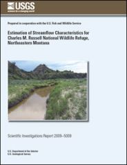
Estimation of Streamflow Characteristics for Charles M. Russell National Wildlife Refuge, Northeastern Montana The Charles M. Russell National Wildlife Refuge encompasses about 1.1 million acres (including Fort Peck Reservoir on the Missouri River) in northeastern Montana. To ensure that sufficient streamflow remains in the tributary streams to maintain the riparian corridors, the U.S. Fish and Wildlife Service is negotiating water-rights issues with the Reserved Water Rights Compact Commission of Montana. The U.S. Geological Survey, in cooperation with the U.S. Fish and Wildlife Service, conducted a study to gage, for a short period, selected streams that cross CMR, and analyze data to estimate long-term streamflow characteristics for CMR. The long-term streamflow characteristics of primary interest include the monthly and annual 90-, 80-, 50-, and 20-percent exceedance streamflows and mean streamflows (Q.90, Q.80, Q.50, Q.20, and QM, respectively), and the 1.5-, 2-, and 2.33- year peak flows (PK1.5, PK2, and PK2.33, respectively)..
Water-Resources Data 2007

Compilation of Water-Resources Data for Montana, Water Year 2007
The U.S. Geological Survey, Montana Water Science Center, in cooperation with other Federal, State, and local agencies, and Tribal governments, collects water-resources data at hundreds of locations in Montana each water year. This report is a compilation of Montana site-data sheets for the 2007 water year, which consist of records of stage, discharge, and water quality of streams and ground water; stage and contents of lakes and reservoirs; water levels in wells; and precipitation data. Site-data sheets for selected stations in Canada and Wyoming also are included in this report.
Featured Project
Clark Fork Water-Quality Monitoring

Scenic view of the Clark Fork near Drummond.
In 1993, a long-term monitoring program was implemented in cooperation with the USEPA at an expanded network of sites in the upper Clark Fork basin. In 2006, supplemental sampling was initiated in cooperation with the USEPA at sites in the lower Clark Fork basin from near Milltown Reservoir to the Flathead River to obtain additional water-quality information related to the removal of Milltown Dam.
 Find out more Find out more
Monthly Conditions Report
APRIL STREAMFLOWS VARY
RESERVOIR STORAGE MOSTLY NORMAL
At eight long-term U.S. Geological Survey gaging stations, the monthly mean streamflows for the month of April were normal at three, above normal at three, and below normal at two. Monthly mean streamflows were normal at:
- Clark Fork at St. Regis
- Yellowstone River at Corwin Springs
- Middle Fork Flathead River near West Glacier
The monthly mean streamflows were above normal at the Blackfoot River at Bonner, Rock Creek below Horse Creek near international boundry, and Yellowstone River at Billings. The monthly mean streamflows were below normal at Yaak River near Troy and Marias River near Shelby.
Water storage remained normal at three out of six major hydroelectric reservoirs in Montana: Canyon Ferry Lake, Bighorn Lake, and Flathead Lake. Monthend storage was above normal in Lake Koocanusa and Hungry Horse Reservoir and remained below normal in Fort Peck Lake.
For the month of April, water storage at all four major irrigation reservoirs was normal: Lima, Clark Canyon, Gibson, and Fresno Reservoirs.
Of Current Interest
USGS Hydrologist from the Montana Water Science Center honored with 2008 Environmental Achievement Award
 The Department of the Interior (DOI) recently honored a team of USGS scientists and partners with the 2008 Environmental Achievement Award for the significant improvements they made to a contaminated aquifer in northeastern Montana. The Environmental Achievement Award recognizes DOI employees and partners who have cleaned up contaminated land and attained exceptional achievements in strengthening federal environmental, energy, and transportation management. The Department of the Interior (DOI) recently honored a team of USGS scientists and partners with the 2008 Environmental Achievement Award for the significant improvements they made to a contaminated aquifer in northeastern Montana. The Environmental Achievement Award recognizes DOI employees and partners who have cleaned up contaminated land and attained exceptional achievements in strengthening federal environmental, energy, and transportation management.
Find out more
USGS Samples for Uranium and Other Radioactive Elements in Jefferson County Ground Water
 The U.S. Geological Survey (USGS) recently sampled ground water in Jefferson County for uranium and other radioactive elements. Scientists with the USGS Montana Water Science Center, in cooperation with the Jefferson Valley Conservation District and Jefferson County, sampled 40 wells throughout Jefferson County last fall and released preliminary findings to Jefferson County officials on February 19, 2008. The U.S. Geological Survey (USGS) recently sampled ground water in Jefferson County for uranium and other radioactive elements. Scientists with the USGS Montana Water Science Center, in cooperation with the Jefferson Valley Conservation District and Jefferson County, sampled 40 wells throughout Jefferson County last fall and released preliminary findings to Jefferson County officials on February 19, 2008.
Find out more
|


