For up-to-date Storm info: NOAA NWS National Hurricane Center
Historical Hurricane Tracks Web Site
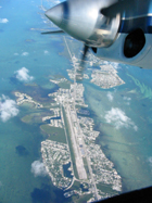
2009 AOC Storm Flight Information
The
Aircraft Operations Center is a Center of the NOAA Marine
and Aviation Office. The airplanes of
the Aircraft Operations Center (AOC) are flown in support
of NOAA's mission to promote global environmental assessment,
prediction and stewardship of the Earth's environment.
NOAA's aircraft operate throughout the United States
and around the world; over open oceans, mountains, coastal
wetlands, and Arctic pack ice. These versatile aircraft
provide scientists with airborne platforms necessary
to collect the environmental and geographic data essential
to their research.
NOAA
demonstrates a challenging and multi-disciplinary approach
to meeting the responsibilities as the "Earth Systems
Agency." The Aircraft Operations Center provides
capable, mission-ready aircraft and professional crews
to the scientific community wherever and whenever they
are required. Whether studying global climate change
or acid rain, assessing marine mammal populations, surveying
coastal erosion, investigating oil spills, flight checking
aeronautical charts, or improving hurricane prediction
models, the AOC flight crews continue to operate in
some of the world's most demanding flight regimes.
|
7-11 Named Storms |
3-6 Hurricanes |
1-2 Category 3+ Storms |
|
These
links may lead to non-NOAA sites
Visitors Center for Monterey Bay National Marine Sanctuary nears groundbreaking
Central Coast
The sea otters, great white sharks and gray whales won't live there. But it will be a key starting point if you want to know where to look for them.
Seventeen years after Congress established the Monterey Bay National Marine Sanctuary, the nation's largest marine sanctuary is finally ready for its own visitors center.
<Read Full Story>
NOAA gets boost from stimulus
Trade Only Today
The federal government plans to invest millions of dollars to support efficient marine navigation and create jobs as part of the American Recovery and Reinvestment Act.
<Read Full Story>
Bill Strengthens to Cat 4: NOAA Sends Hurricane Plane to Have a Look
Miami, FL (AHN)- Hurricane Bill strengthened to a category 4 storm with maximum sustained winds of 135 miles per hour Wednesday morning, forcasters say they expect further strengthening over the next 24 hours.
A NOAA Hurricane Hunter aircraft is headed toward the storm to investigate Bill, the National Hurricane Center said in its 5 a.m. advisory.
<Read Full Story>
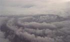
Reader's Digest, September 2009 Issue, "Into the Eye of a Hurricane"
It's August, storm season, and I'm with the storm watchers, flying high off the coast of the United States as a tropical tempest rages around us. As our plane breaks through the towering "eyewall," the dial on the digital wind-speed display drops to zero, the pelting of water on the wings comes to an eerie halt, the clouds fall away from the four huge engines, and suddenly it's as though we're floating peacefully in a snow globewithout the snow. I look up through a circular chimney of ashenclouds to blue sky. Below, though, in the Gulf of Mexico, huge waves are topped with white foam.
<Read Full Story>
HYDROPALOOZA - New Web Site
Scientists from the National Oceanic and Atmospheric Administration (NOAA) are returning to Alaska´s Kachemak Bay in August to continue part two of a large-scale project called Hydropalooza to map Kachemak Bay´s seafloor and coastline. Teams will be working from ships, aircraft, and land, to bring Alaskans accurate data used to support safe maritime transportation, protect coastal communities, assess fisheries and critical marine habitats, and better understand the Bay.
Learn about the ocean and coastal operations taking place on the land, in the sea, and above the horizon and how mapping data can be used by so many people for so many different purposes.
NOAA Planes Get First-Hand Look at Felicia, Aircraft Fly as Close as 80-Miles from Storm's Eye (KITV-ABC Honolulu), August 8, 2009
Crews from the National Oceanic and Atmospheric Administration have been circling Felicia, getting as close as 80 miles from the eye of the hurricane. It is the first storm tracking mission this year for a NOAA plane nicknamed "Gonzo," after its large beak. The Gulf Stream 4 departed the Honolulu International Airport just after 7 p.m. Friday to face off with Felicia.... <Read Full Story>
NOAA Jet Aids In Felicia Forecast (KGMB-CBS Honolulu), August 7, 2009
A specially equip jet took off from Honolulu International Airport early Friday night headed for hurricane Felicia. Its eight hour mission is to collect the data on the storm's wind speed, wind direction, temperature, pressure and humidity...The jet is owned and operated by the National Oceanic and Atmospheric Administration. It flew from its base in Tampa, Florida specifically to help gather information on Felicia...
<Read Full Story>
|


