CRISM (Compact Reconnaissance Imaging Spectrometer for Mars)
HomeOverviewScienceInstrumentsEducationNews CenterGalleryTeam
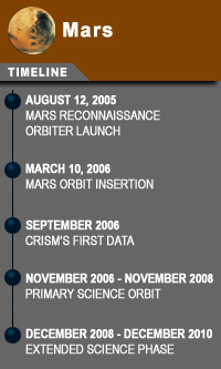
MARS Timeline

Mission Elapsed Time


Beginning 12 Aug. 2005, 11:43:00 UTC


  DAYS         HRS      MINS     SECS
Day Spot 1Day Spot 2Day Spot 3Day Spot 4     Hour Spot 1HourSpot2     Minute Spot 1 Minute Spot 2    Second Spot 1 Second Spot 2
   
Featured ImageCRISM Featured Image RSS Feed
Olivine, Phyllosilicates, and Ancient Crater Rims

Phyllosilicates imaged along weathered crater rims suggests a possible origin for this clay-rich family of minerals.

Read more >

Latest News

December 18, 2008
Scientists Find 'Missing' Mineral and New Mars Mysteries
CRISM team members at the American Geophysical Union's Fall Meeting in San Francisco announce the discovery of intact bedrock layers of carbonate minerals on Mars--an important clue in resolving the mysteries of the Red Planet's watery past.  [more]

December 11, 2008
Mars Orbiter Completes Prime Mission
NASA's Mars Reconnaissance Orbiter has completed its primary, two-year science phase. The spacecraft has found signs of a complex Martian history of climate change that produced a diversity of past watery environments.  [more]

December 4, 2008
NASA Orbiter Finds Martian Rock Record With 10 Beats to the Bar
Researchers using the High Resolution Imaging Science Experiment camera report the first measurement of a periodic signal in the rocks of Mars. This pushes climate-cycle fingerprints much earlier in Mars' history than more recent rhythms seen in Martian ice layers. It also may rekindle debates about some patterns of rock layering on Earth. [more]

All Mars Reconnaissance Orbiter Mission Updates
Team Profiles
Team profile collage
Read about the career paths that led members of the CRISM team into space exploration.
CRISM Spectral Library
The MRO CRISM Spectral Library is an analysis tool for interpreting CRISM data. it currently contains 2,260 spectral analyses of 1,134 Mars-analog samples, all measured under desiccating conditions so that materials that adsorb water look as they would on Mars. This was made avaialble to the community through the PDS on the day that MRO entered Mars orbit!
   

Register Online for 2009 CRISM Workshop
CRISM View

Thousands of CRISM high-resolution images are available in easy-to-view format accessible through a searchable map. More are being added as they are converted from the full spectral data... [more]

CRISM Corner

August 2009
CRISM Scans Mars’ Limb for New View of the Atmosphere
CRISM team members are analyzing data from two new pole-to-pole sets of vertical scans of Mars' atmosphere, to provide detailed measurements of how trace gases and clouds vary with height above the Red Planet's surface. [more]

February 2009
CRISM Observations Featured in Latest Release of Google Earth!
The recently released Google Earth 5.0 lets users take a virtual ride through deep canyons and across vast plains, but not only on the planet you’d expect. The program also lets you tour Mars and access observations made by the CRISM imaging spectrometer on NASA's Mars Reconnaissance Orbiter (MRO). [more]

CRISM View

CRISM View is a first-of-its-kind opportunity to watch Mars through the “eyes” of the Compact Reconnaissance Imaging Spectrometer for Mars (CRISM) – as if you were riding along with it on the Mars Reconnaissance Orbiter! [more]
MSL Site Selection
CRISM has been supporting landing site selection for the Mars Science Laboratory (MSL) mission with hundreds of observations that have been converted to color and mineral indicator maps. [more]

CRISM Facts
The MRO launched in August 2005 from Cape Canaveral Air Force Station, Florida.

view all CRISM facts >

 
NASA - National Aeronautics and Space Administration                The Johns Hopkins University Applied Physics Laboratory                CRISM              JPL
Editor: JHU/APL Webmaster
JHU/APL Official: K. Beisser

+ Contact JHU/APL
Back to CRISM Main Page