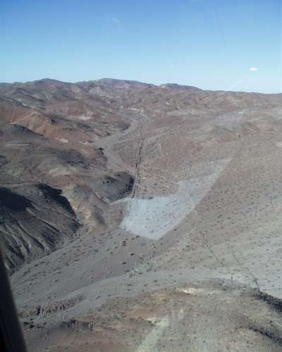
Title: Aerial Photo of the Surface Rupture
Description: View right along the main rupture zone, and also visible is a subsidiary fracture from lower-right corner coalescing with the main break in the middle distance.
Location: CA, USA
Date Taken: 10/1/1999
Photographer: Paul "Kip" Otis-Diehl,
USMC, 29 Palms
Usage: This image is public domain/of free use. Please refer to the USGS Copyright section for more details.
Source:
File Size (original): JPEG Image - 401.92 KB
Suggest an update to the information/tags?
Tags: HectorMine aerial earthquake mountains


")


