Title: Aerial Photo of the Surface Rupture
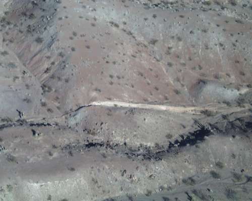
Description: Southeast of maximum displacement site. Here we see 3-4 meters of right-lateral slip have offset a ridge and created a 'shutter' ridge blocking flow in the dry creek channel. The white vertical surface is the fault scarp.
Location: CA, USA
Date Taken: 10/1/1999
Photographer: Paul "Kip" Otis-Diehl,
USMC, 29 Palms
Usage: This image is public domain/of free use. Please refer to the USGS Copyright section for more details.
Source:
File Size (original): JPEG Image - 214.21 KB
Suggest an update to the information/tags?
Tags: HectorMine aerial earthquake


")


