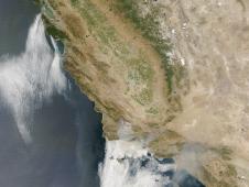
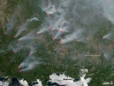
On August 12, 2009, the Lockheed Fire broke out in the mountains southwest of San Jose, California, and burned through an estimated 2,600 acres of brush and timber by the morning of August 14. The fir...
MODIS Rapid Response
Top U.S. Image
Top World Image
Fire on La Palma, Canary Islands
A fire on La Palma, one of the least developed of the Canary Islands, off the west coast of Africa, forced several thousand people to evacuate homes and tourist accommodations during the first weekend...
News and Features
-

Tracking South Carolina Wildfires
05.08.09 - Researchers from NASA Langley's Science Directorate jumped into action recently, studying wildfire smoke with EPA partners.
-

NASA Study: Climate Fuels Asian Wildfire Emissions
04.30.09 - Fires in equatorial Asia are growing more frequent and having a serious impact on the air as well as the land.
-

CALIPSO Sees Through the Haze
04.22.09 - New research shows that the warming effect of aerosols, or small particles in the air, increases with the amount of cloud cover below the aerosols.
-

CALIPSO Finds Smoke at High Altitudes Down Under
03.05.09 - CALIPSO traced vertically through the layers of the atmosphere to study the smoke from Australian bushfires in February.


