Winds aloft are computer prepared and contain forecast wind direction and speed as well
as forecast temperatures. The standard FB levels are as follows:
Low Level
CONUS, AK
- 3,000 feet
- 6,000 feet
- 9,000 feet
- 12,000 feet
- 18,000 feet
- 24,000 feet
- 30,000 feet
- 34,000 feet
- 39,000 feet
|
HI, WPAC
- 1,000 feet
- 1,500 feet
- 2,000 feet
- 3,000 feet
- 6,000 feet
- 9,000 feet
- 12,000 feet
- 18,000 feet
- 24,000 feet
|
|
High Level
CONUS, AK
- 45,000 feet
- 53,000 feet
|
HI, WPAC
- 18,000 feet
- 24,000 feet
- 30,000 feet
- 34,000 feet
- 39,000 feet
|
|
All levels through 12,000 feet are true altitude (MSL). The levels 18,000 feet and
above are pressure altitude. Wind direction is from true north. No winds are forecast
within 1,500 feet of station elevation. Also, no temperatures are forecast for the
3,000 foot level or for any level within 2,500 feet of station elevation. Temperature
is in whole degrees Celsius and assumed to be negative above 24,000 feet.
Sample winds aloft text message:
DATA BASED ON 010000Z
VALID 010600Z   FOR USE 0500-0900Z. TEMPS NEG ABV 24000
FT  3000    6000   9000    12000   18000   24000  30000  34000  39000
MKC 2426 2726-09 2826-14 2930-21 2744-32 2751-41 275550 276050 276547
Sample message decoded:
DATA BASED ON 010000Z
Forecast data is based on computer forecasts generated the first day of the month
at 0000 UTC.
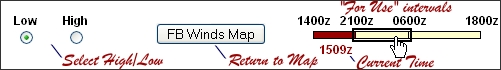
VALID 010600Z FOR USE 0500-0900Z. TEMPS NEG ABV 24000
The valid time of the forecast is the first day of the month at 0600 UTC. The forecast
winds and temperature are to be used between 0500 and 0900 UTC. Temperatures are
negative above 24,000 feet.
FT 3000 6000 9000 12000 18000 24000 30000 34000 39000
FT indicates the forecast location, the numbers indicate the forecast levels.
MKC 2426 2726-09 2826-14 2930-21 2744-32 2751-41 275550 276050 276547
This example shows data for MKC (Kansas City, MO). The 3,000 foot wind is forecast to
be 240 degrees at 26 knots. The 6,000 foot wind is forecast to be 270 degrees at 26
knots and the air temperature is forecast to be -9 degrees Celsius. The 30,000 foot
wind is forecast to be 270 degrees at 55 knots with the air temperature forecast to
be -50 degrees Celsius.
Wind direction is coded as a number between 51 and 86 (vice 01 to 36) when the wind speed is 100 knots or greater.
To derive the actual wind direction, subtract 50 from the first pair of numbers. To derive wind speed, add 100 to the second pair of
numbers. For example, a forecast at 39,000 feet of "731960" shows a wind direction from 230 degrees (73-50=23) with a wind
speed of 119 knots (100+19=119). Above 24,000 feet the temperature is assumed to be negative, therefore the third pair of numbers
indicate a temperature of minus 60 degrees Celsius.
If the wind speed is forecast to be 200 knots or greater, the wind group is coded as
199 knots. For example, "7799" is decoded as 270 degrees at 199 knots or greater.
Wind direction is coded to the nearest 10 degrees. When the forecast speed is less
than 5 knots, the coded group is "9900" and read, "LIGHT AND VARIABLE."
|