|
|
|
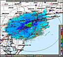
Quick Glimpse at the Weather
|
|
|
|
 Area Forecast Discussion - Area Forecast Discussion - High pressure will build over the region today and move off to the south tonight. A cold front will move through from the northwest Wednesday night followed by high pressure Thursday. A low pressure system from the south could affect the region this weekend. Please see the latest outlooks from the tropical prediction center concerning this low. ...read the full AFD...
|
Choose from the options below for other ways to view your NWS forecast
|
|
What's New
|
-
NOAA Selects Contractor to Develop GOES-R Ground System
NOAA announced that Harris Corporation has been selected to develop the GOES-R ground system, which will
capture, process and distribute information from NOAA´s next generation geostationary satellite series
to users around the world.
read more ...
|
 and additional resources
|

|
|
|
|
|
|

|
Question? Click here to
Ask a Meteorologist
|
|
Need help with the language that meteorologists use?
Contractions
Acronyms
Glossary
|
-
EXPERIMENTAL FEEDS AND WEB DISPLAYS OF WATCHES, WARNINGS AND
ADVISORIES - NOAA's National Weather Service offers several XML services that provide access
to NWS watches, warnings, advisories, and other similar products.


Read more...
How to read RSS feeds...
|
-
SKYWARNTM
is a concept developed in the early 1970's that was intended to promote a cooperative
effort between the National Weather Service and communities. The emphasis of the effort is often
focused on the storm spotter, a trained volunteer that reports hazardous weather conditions to their
local forecast office.
-
The
Operational Significant Event Imagery
team produces high-resolution, detailed imagery of significant environmental events.
More...
-
The NOAA Photo Library is a Rich Resource that spans centuries of time and much
of the natural world from the center of the Earth to the surface of the Sun. It has been
built in an attempt to capture NOAA's scientific heritage, which is in fact a heritage
shared by much of the physical and environmental science communities in the United
States today. To date, over 16,000 images have been digitized and reside in the online
NOAA Photo Library.
Go there now...
-
U.S. Daily Weather Maps Project
This site provides access to daily weather maps from 1871 to the present.
More...
|
|
Seasonal Weather Tips
|
-
Severe Weather -
Thunderstorms, Tornadoes, and Lightning
-
Flooding -
In the long term, floods kill more people in the United
States than other types of severe weather. In recent
years, only heat surpassed flood fatalities.
-
Fire Weather -
NOAA´s National Weather Service has a cadre of around 60 meteorologist that are specially trained to go to wildfires and other incidents and give weather briefings and forecasts to the incident responders and command staff.
-
Weather Safety -
Preparedness
-
Rip Currents -
Rip currents are powerful, channeled currents of water flowing away from shore.
They typically extend from the shoreline, through the surf zone, and past the line
of breaking waves.
Visit NOAA's Rip Current Safety Web Site
Surf Zone Forecast
-
Lightning Safety Outdoors -
Each year, about 400 children and adults in the U.S. are struck by lightning while
working outside, at sports events, on the beach, mountain climbing, mowing the
lawn or during other outdoor activities. About 67 people are killed and several
hundred more are left to cope with permanent disabilities. Many of these tragedies
can be avoided. Finishing the game, getting a tan, or completing a work shift
aren't worth death or crippling injury.
Read more...
|
|
Adjacent Weather Forecast Offices (WFOs)
|
|
Local Climate, Hydrology and Weather Topics
|
|


 WSR-88D Radar FAQ

 NOAA data server

