| Home | |
| Overview | |
|
|
|
|
|
|
| Publications |
| Wildfire ABBA |
| Time-Series | |
| Interesting Examples | |
| Archive |
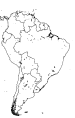
The experimental Wildfire Automated Biomass Burning Algorithm (WFABBA) is currently generating half-hourly fire data for the Western Hemisphere. The geostationary NOAA weather satellite GOES-12 provides coverage for North and South America while GOES-11 covers North America only. The WFABBA is an extension of the ABBA.
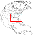
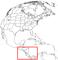
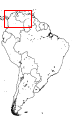
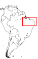
The results from the WFABBA are typically available within 90 minutes of the satellite scan time. The GIF images are accessible from the links below. Each link leads to a page with the most recent image and provides the option to go to higher-resolution images of different regions as well as loops of the images covering the last several hours (or days, depending on the region).
The WFABBA imagery is generated using a modified alpha-blending technique. Data from the GOES satellites and a landcover map derived from 1-km resolution Advanced Very High Resolution Radiometer (AVHRR) data (available here) are used to produce the combined image, on top of which the fires are placed and the map and annotations are drawn. Continental overview images have plotted locations of fires, while regional view images indicate the individual satellite fire pixels as detected with the WFABBA.
Fires from the WFABBA are divided into six categories: processed fire, saturated fire pixel, cloudy fire pixel, high possibility fire pixel, medium possibility fire pixel, and low possibility fire pixel. Data noise, extremely hot surfaces, and sometimes cloud shadows can give false alarms for fires. The vast majority of processed fire pixels are not false alarms.


The biomass burning products displayed on this web site were developed and produced with support from the National Aeronautics and Space Administration and the Space and Naval Warfare Systems Center, San Diego, CA under contract No. N66001-00-C-0039.
Any opinions, findings and conclusions or recommendations expressed in this material are those of the author(s) and do not necessarily reflect the views of the Space and Naval Warfare Systems Center, San Diego, CA.
NOTICE: To maintain the integrity of the data, use of this data for publications, posters, or talks requires an offer of authorship to the UW-Madison CIMSS GOES Biomass Burning Monitoring Program. Please send authorship requests to Elaine.Prins@ssec.wisc.edu.
Contact:
elaine.prins@ssec.wisc.edu
chris.schmidt@ssec.wisc.edu
2001 June 19