WaterWatch -- Current Water Resources Conditions |
|
| ||||
|
WaterWatch -- Current water resources conditions
Map of flood and high flow condition (United States)
Google Maps version of this map
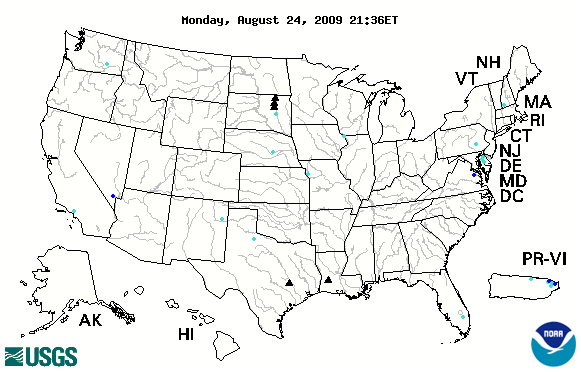
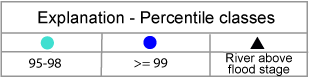
The "Flood and high flow" map shows the location of streamgages where the water level is currently at or above flood stage (depicted as a black triangle) or at high flow (depicted as blue circles) The high flow conditions are expressed as percentiles that compare the current (i.e., within the past several hours) instantaneous flow value to historical daily mean flow values for all days of the year. Please note that flood conditions may be more extensive than shown on the map because the National Weather Service (NWS) has not identified a flood stage (for flood forecasting purposes) at all USGS streamgages. Also, the NWS has determined flood stages for some non-USGS streamgages, which are not shown on the map. The most complete depiction of streamgages at or above flood stage is on the NWS River Conditions Map.
The real-time data used to produce this map are provisional and have not been reviewed or edited. They may be subject to significant change. Also, in this regard, during winter months the flood and high flows appearing on the map in some states may result from ice effects.
Alternative data formats of this map in postscript , GIS coverage, or GIS shapefile are available.

![]() U.S. Department of the Interior |
U.S. Geological Survey
U.S. Department of the Interior |
U.S. Geological Survey
URL: http://water.usgs.gov/waterwatch
Page Contact Information: Contact USGS
Page Last Modified: Monday, August 24, 2009
