 |
|
|
||||
| USGS › Geography › Earth Resources Observation and Science (EROS) Center |

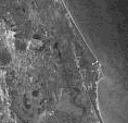
Declassified Satellite Image |
Declassified Satellite Imagery - 1 consists of approximately 880,000 photographic images that were taken between 1959 and 1972. These images were primarily collected by the CORONA satellite series, but the dataset also includes photos taken from the ARGON and LANYARD satellites. The images have multiple scales and the image quality can be variable. Cloud cover is common. The digital products are produced from a duplicate negative source. The original film and technical mission-related documents are maintained by the National Archives and Records Administration (NARA)
| CORONA | |||
|---|---|---|---|
| Mission Designators | Film Size | Micron Size | Black and white (B/W) |
| KH-1 KH-2 KH-3 KH-4 KH-4A KH-4B |
70 mm x 29.8 inch | 21 Micron (1200 dpi) | 36 MB (x 4 files) |
| 14 Micron (1800 dpi) | 80 MB (x 4 files) | ||
| 7 Micron (3600 dpi) | 319 MB (x 4 files) | ||
| ARGON | |||
|---|---|---|---|
| Mission Designators | Film Size | Micron Size | Black and white (B/W) |
| KH-5 | 5 x 5 in | 21 Micron (1200 dpi) | 40 MB |
| 14 Micron (1800 dpi) | 80 MB | ||
| 7 Micron (3600 dpi) | 335 MB | ||
| LANYARD | |||
|---|---|---|---|
| Mission Designators | Film Size | Micron Size | Black and white (B/W) |
| KH-6 | 5 x 25 in | 21 Micron (1200 dpi) | 40 MB (x 3 files) |
| 14 Micron (1800 dpi) | 80 MB (x 3 files) | ||
| 7 Micron (3600 dpi) | 325 MB (x 3 files) | ||
The above sizes may vary due to scanning more than just image data. With our policy to scan the surrounding metadata and the addition of the USGS logo the actual image size will generally be larger than the estimates above.
| Mission Designators | Micron Size |
|---|---|
| 70 mm x 29.8 inch | 21 Micron* |
| 14 Micron | |
| 7 Micron* (for 4A & 4B) | |
| 5 x 5 inch | 21 Micron* |
| 14 Micron | |
| 7 Micron | |
| 5 x 25 inch | 21 Micron* |
| 14 Micron | |
| 7 Micron* |
All Declassified Satellite Imagery - 1 can be searched through EarthExplorer.
Declassified Satellite Imagery - 1 is not available as a Medium Resolution Digitized product at this time.
Businesses that offer information and support services for the National Archives and Records Administration (NARA) Declass collections include the following companies:
Businesses that can provide printed images from USGS digital data.
Declassified Satellite Imagery - 1 should always be previewed online prior to purchase. Browse images of all scenes are available by searching on EarthExplorer.
| Accessibility FOIA Privacy Policies and Notices | |
 |
|