Lunar Topography in Natural Color
|
|
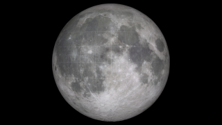
This animation is a brief tour of several prominent features of the Moon's terrain: Tycho crater, the south pole, and the South Pole-Aitken basin. It is match-moved to a companion piece showing the terrain elevations in false color. The surface appearance is derived from photographs taken by the Clementine spacecraft. Although it shows the visible surface in natural color, this animation does not depict realistic sunlight and shadows. This is especially significant near the poles, where certain parts of the terrain can be in permanent shadow and would never be fully visible in the manner depicted here.
|
|

|
|
Moon natural color topo flyover
Duration: 1.7 minutes
Available formats:
1280x720 (30 fps)
Frames
512x288 (30 fps)
MPEG-1
21 MB
1280x720 (30 fps)
MPEG-2
56 MB
1280x720 (30 fps)
MPEG-4
9 MB
320x180
PNG
122 KB
160x80
PNG
31 KB
80x40
PNG
8 KB
How to play our movies
|
|

|
|
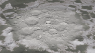
Tycho crater and its bright ejecta rays are among the youngest and most recognizable features on the Moon. The crater is 85 kilometers (50 miles) wide and 4700 meters (15,400 feet) deep. The central peak is 2400 meters (7900 feet) above the crater floor.
Available formats:
2560 x 1440
TIFF
2 MB
320 x 180
PNG
284 KB
|
|

|
|
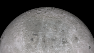
The floors of deep craters near the poles, including bowl-shaped Shackleton near the center of this view of the south pole, are in permanent shadow (not shown here) and are therefore cold and dark enough to harbor potential deposits of water ice.
Available formats:
2560 x 1440
TIFF
2 MB
320 x 180
PNG
289 KB
|
|
|
|
The South Pole-Aitken basin, the large, dark patch centered in the image, is roughly 2100 kilometers (1300 miles) wide and 10 kilometers (6 miles) deep, perhaps the largest impact feature in the solar system. It lies on the far side of the Moon, the hemisphere never visible from Earth, and was found only after spacecraft began visiting the Moon in the 1960s.
Available formats:
2560 x 1440
TIFF
3 MB
320 x 180
PNG
215 KB
|
|
|
Back to Top
|

