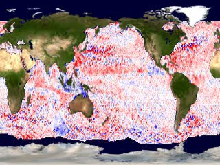
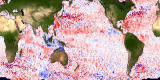
Sea Surface Height Anomaly, 2003-2005 (WMS)
|
Changes in the normal height of the ocean's surface were observed by the TOPEX/Poseidon altimeter.
|
|

|
|
This animation shows the sea surface height anomaly. This animation is primarily designed to be accessed from the SVS Web Map Services (WMS) server. Each frame represents the accumulation of data over about a 10-day period ending at the date and time indicated in the WMS metadata.
Duration: 4.0 seconds
Available formats:
360x180
Frames
1280x720 (29.97 fps)
MPEG-2
8 MB
320x240 (30 fps)
MPEG-1
761 KB
720x480 (29.97 fps)
MPEG-2
3 MB
80x40
PNG
9 KB
320x240
JPEG
66 KB
160x80
PNG
36 KB
320x240 (30 fps)
X-FLV
348 KB
How to play our movies
|
|
This product is available through our Web Map Service.
Click here to learn more.
|
|

|
|
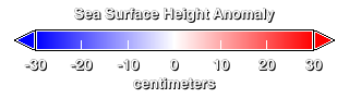
This is the colorbar for the sea surface height anomaly animation.
Available formats:
320 x 90
PNG
10 KB
|
|
|
Back to Top
|


