


 TWP Manus Site
Location: 2° 3' 39.64" S, 147° 25' 31.43" E
Altitude: 6 meters
In August 1996, our first climate research facility in the Tropical Western Pacific locale was established. The Manus facility is located at Momote Airport on Los Negros Island in Manus Province, Papua New Guinea (PNG). This location was chosen because of its location in the heart of the Pacific warm pool, the existence of an Integrated Sounding System operated by National Oceanic and Atmospheric Administration (NOAA), and the support of the PNG National Weather Service (NWS).
Daily Operations
Daily Operations of the Manus facility are a joint effort between the PNG NWS and Tropical Western Pacific Office (TWPO). In this collaboration, a staff of NWS employees serves as on-site observers to operate instruments and report their status to TWPO daily. In addition, technicians from the Australian Bureau of Meteorology (BOM), as well as personnel at TWPO, provide a 24-hour support for daily operations and instrument troubleshooting.


Instruments
Current list of Manus instruments.
Useful Links
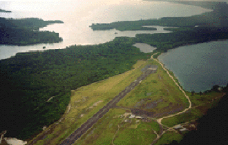
Momote Airport from the air.