The content of the ARM website is available to any browser, but for the best experience we highly recommend you upgrade to a standards-compliant browser such as Firefox, Opera or Safari.

Field Campaigns
Call now closed for FY 2011 AMF/AAF proposals; learn more about ACRF campaigns

Feature
Preparations heat up for field campaign in Chile
Research Spotlight
Research Team Publishes Results from In-Depth Study of Sahel Climate System
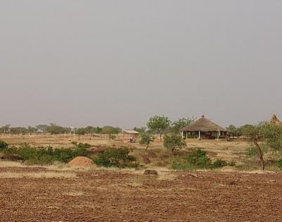
Using data from the 2006 ARM Mobile Facility deployment in Niamey, Niger, an international team of researchers funded by the ARM Program, the National Aeronautics and Space Administration, and the United Kingdom's Natural Environmental Research Council published a series of eight papers between 2008 and 2009 in the Journal of Geophysical Research-Atmospheres. Results from these studies indicate a significant advancement in the scientific understanding of the climate system in the sensitive sub-Saharan, or Sahel, region of Africa.
See ARM News Center story
Research Spotlight

Upgrades to Cloud Radar Lead to New Data Product: MicroARSCL
Between 2004 and 2006, the ACRF completed upgrades to the digital portion of the millimeter wave cloud radar (MMCR) receivers—a key capability that provides detailed information about cloud properties at the ACRF sites. These upgrades significantly improved the radar's temporal resolution, extended the interval for detecting velocity, and allowed continuous recording of Doppler spectra. Using these improved measurements, researchers developed a new evaluation tool called the Microphysical Active Remote Sensing of Clouds (MicroARSCL). This tool automatically packages into an efficient summary the important characteristics of the Doppler spectrum and more accurate identification of radar clutter.
A MicroARSCL data set for the period from May 2007 through May 2008 at the ACRF Southern Great Plains site is currently available at the ACRF Data Archive. Additional ACRF sites and time periods will be added to the MicroARSCL data set in the future.
The first time you visit the Archive you will need to create a new account—a relatively short form asking for contact information—you can use right away. Order MicroARSCL data now.
Research Spotlight

Data Available for Aerosol Indirect Effects Study in China
Data collected by the ARM Mobile Facility in Shouxian during the Aerosol Indirect Effects Study in China from May through December 2008 are now in the Data Archive. Extensive measurements of clouds, aerosols, radiation, and precipitation will help scientists to examine the role of aerosols in affecting the regional climate and atmospheric circulation.
To check availability, visit the instrument and data plot page. To order the data, go to the ACRF Data Archive.
Please contact the Archive if you have any login questions.
RACORO Campaign Complete

In the first long term aircraft campaign of its kind, the RACORO field campaign wrapped up flight operations on June 30. Guided by a seven-member science steering committee, the team logged 259 research hours from the skies above Oklahoma. The five-month campaign obtained a statistical data set of cloud, aerosol, radiative, and atmospheric state measurements.
See ARM News Center story
Atmospheric Radiation Measurement Program
The Atmospheric Radiation Measurement (ARM) Program is the largest global change research program supported by the U.S. Department of Energy. The primary goal of the ARM Program is to improve the treatment of cloud and radiation physics in global climate models in order to improve the climate simulation capabilities of these models.
To achieve this goal, ARM scientists and researchers around the world use continuous data obtained through the ARM Climate Research Facility. This scientific user facility provides a unique asset for interdisciplinary global change research among the national and international scientific community.
About ARM