
 Feeds & Data
Magnitude 4.2 - VANCOUVER ISLAND, CANADA REGION
2009 August 06 22:39:37 UTC
Earthquake Details
| Magnitude | 4.2 |
|---|---|
| Date-Time |
|
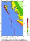
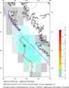
| Location | 50.516°N, 130.374°W |
| Depth | 10 km (6.2 miles) set by location program |
| Region | VANCOUVER ISLAND, CANADA REGION |
| Distances |
|
| Location Uncertainty | Error estimate not available |
| Parameters | NST= 49, Nph= 49, Dmin=159.7 km, Rmss=0 sec, Gp=187°, M-type=regional moment magnitude (Mw), Version=6 |
| Source |
|
| Event ID | us2009jzb5 |
- This event has been reviewed by a seismologist.
- Did you feel it? Report shaking and damage at your location. You can also view a map displaying accumulated data from your report and others.


Earthquake Maps


Scientific & Technical Information
 Historic Moment Tensor Solutions
Additional Information, News Reports
- Preliminary Earthquake Report
- U.S. Geological Survey, National Earthquake Information Center:
World Data Center for Seismology, Denver
