|
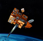
The SeaWinds scatterometer is a specialized microwave radar that measures near-surface wind velocity (both
speed and direction) under all weather and cloud conditions over Earth's oceans. The experiment is a follow-on
mission and continues the data series initiated in 1996 by the NSCAT.
SeaWinds uses a rotating dish antenna with two beams. The antenna radiates microwave pulses at a
frequency of 13.4 gigahertz across broad regions on Earth's surface. SeaWinds will collect data in a continuous
1,800-kilometer-wide band, making approximately 400,000 measurements per day.
Mission
SeaWinds is a part of the Earth Observing System (EOS) which is designed to address global environmental
changes, and is a joint mission with the
National Space Development Agency of Japan (NASDA).
Winds are a critical factor in determining regional weather patterns and climate. Oceans cover 70 percent of
Earth's surface, and as the only remote-sensing system to provide accurate, frequent, high-resolution measurements
of ocean surface wind velocities, under all weather conditions, scatterometers play an increasingly important role in
oceanographic, meteorological and climate studies.
As part of the SeaWinds Project, NASA sponsors a team of scientific investigators who advised the project
during the development of the instrument and ground data processing system. The science team will conduct
research with SeaWinds data; their studies are expected to lead to improved methods of global weather
forecasting and modeling.
 |
 |
 |
|
Unloading of the bus module and unit containers at Tanegashima on Wednesday, 26 Sep 2001. |
 |
 |
|
Cargo ship loaded with ADEOS-II bus modules, SeaWinds and other mission modules arrive at Shimama port
in Tanegashima on Tuesday, 25 Sep 2001. |
Science Objectives
-
Acquire all-weather, high-resolution measurements of near-surface winds over the global
oceans
-
Determine atmospheric forcing, ocean response and air-sea interaction mechanisms on various spatial and
temporal scales
-
Combine wind data with measurements from scientific instruments in other disciplines to understand
mechanisms of global climate change and weather patterns
Operational Objectives
-
Improve weather forecasts near coastlines by using wind data in numerical weather- and wave-prediction
models
-
Improve storm warning and monitoring
Instrument Description
| Radar: |
13.4 gigahertz; 110-watt pulse at 189-hertz PRF |
| Antenna: |
1-meter-diameter rotating dish producing 2 spot beams sweeping in a circular pattern |
| Mass: |
200 kilograms |
| Power: |
220 watts |
| Average Data Rate: |
40 kilobits per second |
Measurements
-
1,800-kilometer swath during each orbit provides approximately 90-percent coverage of Earth's oceans
every day
-
Wind-speed measurements of 3 meters/ second to 20 meters/ second with 2 meters/ second
accuracy; direction with 20 degrees accuracy
-
Wind vector resolution of 50 kilometers
Winds over the ocean modulate air-sea changes in heat, moisture, gases and particulates, regulating the
crucial bond between atmosphere and ocean that establishes and maintains global and regional climate.
Measurements of surface wind velocity can be used in regional and global numerical weather models to improve
our ability to predict weather.
As the only remote-sensing system to provide accurate, frequent, high-resolution measurements of ocean
surface wind velocities, under all weather conditions, scatterometers play an increasingly important role in
oceanographic, meteorological and climatic studies.
SeaWinds was scheduled to launch on board ADEOS-II from Tanegashima, Japan in February 2002, but
NASA has been advised by the National Space Development Agency of Japan (NASDA) that the Japanese Space
Activities Commission (SAC) want to have 3 successful H-IIA rocket launches prior to the ADEOS-II launch. This sets
the ADEOS-II launch to take place no earlier than November 2002. The SeaWinds Project is managed for NASA's
Earth Science Enterprise by the Jet Propulsion Laboratory, a division of the California Institute of Technology.
|
 |