|
AVIATION
WEATHER
|
|
 |
WELCOME
to our Aviation Page! This page
is intended for pilots of all skill
levels to be able to access weather
data for the southwest.
Follow along the chart to the left
to obtain weather relevant to your
flight. The intent of this toolbar
is for pilots to get a good look
at the weather, then call the FSS
in order to get an OFFICIAL
Pilot Weather Briefing. ** Call
1.800.WXBRIEF for a legal brief
**.
Looking for quick specific information?
Below you will find weather sources
that provide you with surface observations,
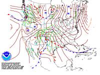
PIREPs, soaring info, RADAR,
SIGMETS, turbulence, icing, forecasts,
and links to other aviation sites!
Information on the SAWS2 Workshop can
be found here.
|
|
A)
Current Surface Observations (METARs)
These reflect current weather conditions
at many observing stations from around Arizona
and her neighboring states. Many of these observations
are from NWS ASOS units (Automated Surface Observing
Systems). Some of the observed parameters include:
sky condition, visibility, temperature, dew point,
wind and pressure (as well as additive remarks).
To select multiple observations use the ctrl or Shift keys.
Arizona:
Surrounding Southwestern States:
For a GRAPHICAL depiction of surface observations,
please check out the following link: http://adds.aviationweather.gov/metars/
B)
Aviation Terminal Forecasts (TAFs) - Native format
Specialized forecasts for selected airports
across Arizona and surrounding areas. Intended
primarily for aviators and meteorologists; in
coded METAR format.
Additional
TAFs at the Aviation Weather Center
C)
Winds and Turbulence
Find the forecasted winds and temperatures
aloft along your flight path. Look at PIREPS regarding
turbulence, icing and sky conditions in the area.
You will find several useful links below including
an interactive JAVA tool for PIREPS!
D)
Icing
See Current Icing Potential (CIP) at
various flight levels.
E)
Radar and Satellite Imagery
F)
EXPERT Mode!
Do you know exactly what you're looking
for? If so, you can jump directly to it by entering
the 7-9 character NWS AWIPS identifier below.
(fast!)
G)
AIRMET and SIGMETSs
H)
Aviation Links
|