Before departure, call 1-800-WX-BRIEF for latest weather and to file flight plans.
Current Conditions
Airmets, Current Obs & Pireps
TAFs &Discussions
Aviation Weather Center
Local Airport Info/Misc
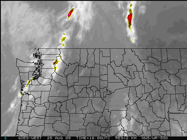
Quick Look Radar/Satellite
Radar and Satellite Data
Radar | VIS | IR | WV Flight Category | Radar Summary move mouse over links to change image
Close-up Radar/Satellite:
USA Radar/Weather:
1. USA Radar Summary
2. Weather Depiction Chart
3. "Old style" Radar Summary
State Hourly Weather Reports MT | ID | WA | WY | OR |
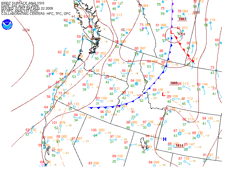
Current Pacific NW and Northern Rockies Surface Analysis and Forecasts out to 48 hrs
For local time, subtract 7 hrs during MST (or 6hrs MDT) (12Z would be 6 am MDT) Analysis | 12-hr | 24-hr | 36-hr | 48-hr | Other Plots
Click on Analysis link to view larger image below
Webmaster US Dept of Commerce National Oceanic and Atmospheric Administration National Weather Service Missoula Weather Forecast Office 6633 Aviation Way Missoula, MT 59808-9381 Tel: (406) 329-4840


