The Landsat Program - News
How Landsat Helps
Learn more about the ways in which Landsat helps society.
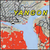
- USDA FAS Uses GIS, MODIS, and Landsat to Monitor Rice Production in Burma
- Satellite imagery was obtained from the MODIS satellite and used rice land-cover classification data from Landsat to monitor rice production.
- Landsat Satellite Imagery Used to Assess the Impact of Burma’s Cyclone Nargis
- USGS is providing Landsat satellite imagery to aid rescue and recovery efforts in Burma
- Landsat’s Role in Chesapeake Bay Management
- Information collected by the Landsat satellites, has brought Bay scientists one step closer to better controlling pollution levels throughout the watershed.
More social benefits articles.


