The Landsat Program - News

When it happened
AUGUST 2007
Aug. 31 • Satellites let scientists view Earth as integrated system
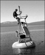
Aug. 28 • Sensor synergy: Great Lakes algae monitoring
Aug. 23 • Landsat data used in award winning map
Aug. 14 • Secretary of the Interior comments on new National Land Imaging Program
Aug. 14 • U.S. releases plan for National Land Imaging Program
Aug. 09 • Landsat helps rain forest protection work in Peru
Past Events
June 2009 | May 2009 | April 2009 | March 2009 | February 2009 | January 2009 | December 2008 | November 2008 | October 2008 | September 2008 | August 2008 | July 2008 | June 2008 | May 2008 | April 2008 | March 2008 | February 2008 | January 2008 | December 2007 | November 2007 | October 2007 | September 2007 | August 2007 | July 2007 | June 2007 | May 2007 | April 2007 | March 2007 | February 2007 | January 2007 | December 2006 | November 2006 | October 2006 | September 2006 | August 2006 | July 2006 | June 2006 | May 2006 | April 2006 | March 2006 | February 2006 | January 2006 | November/December 2005