
- Home
- About S&T
- Taxa/Organisms
- Ecosystems
- Issues
- Methods & Tools
- Reports & Publications
- Location
- Search
Publisher: USGS | Format: URL
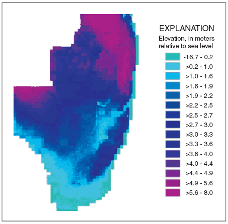
pubs.usgs.gov — This web resource describes the U.S. Geological Survey (USGS) Across Trophic Level System Simulation (ATLSS) Program, which has produced a set of models, including spatially explicit species index models, population demography models, and ecosystem process models that are designed to evaluate the ecological effects of hydrologic scenarios on More...
Publisher: USGS | Science Center: Florida Integrated Science Center (FISC, Gainesville) | Format: URL
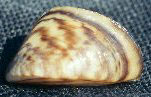
fl.biology.usgs.gov — This web resource is a map representation of the distribution of zebra and quagga mussels in U.S. lakes. Zebra mussels were first detected in 1988 in Lake St. Clair, located between Lake Huron and Lake Erie. Within just a few years, they spread into all five of the Great Lakes. Since then, zebra mussels have spread into many large navigable More...
Publisher: USGS | Science Center: Fort Collins Science Center (FORT, Ft. Collins) | Format: URL
www.fort.usgs.gov — Smart River GIS allows simultaneous views of river hydraulics, species specific habitat, and fish population simulations, for a better understanding of complex ecological interactions. Scientists used existing data sets from the South Platte River in Colorado to develop a prototype, with multiple layers of geographic information system, GIS, More...

