
HYDROLOGIC DATA
ABOUT THE CALIFORNIA WSC
USGS IN YOUR STATE
USGS Water Science Centers are located in each state.

|
11143000 BIG SUR RIVER NEAR BIG SUR, CA — WEBCAM
|
 This webcam is located in
Pfeiffer Big Sur State Park, at the USGS stream-gaging station on
BIG SUR RIVER NEAR BIG SUR
(see map).
The Basin Complex Fire of July 2008 caused moderate to high soil burn to 84% of the 58 mi2
Big Sur River watershed, of which 46.5 mi2 is upstream of this gage.
The California State Emergency Assessment Team
(SEAT),
and the U.S. Forest Service Burned Area Emergency Response
Team (BAER) have designated portions of
Pfeiffer Big Sur State Park and downstream communities, as being at high risk
for loss of property and life from these potentially catastrophic geomorphic events.
This camera will provide the
capability to visually monitor the stream both day and night by use of an infrared light source.
For more information, see USGS research on Post-Wildfire Landslide Hazards.
This camera was installed with the support of the California Dept. of Parks and Recreation, Monterey Division, Big Sur Sector.
This webcam is located in
Pfeiffer Big Sur State Park, at the USGS stream-gaging station on
BIG SUR RIVER NEAR BIG SUR
(see map).
The Basin Complex Fire of July 2008 caused moderate to high soil burn to 84% of the 58 mi2
Big Sur River watershed, of which 46.5 mi2 is upstream of this gage.
The California State Emergency Assessment Team
(SEAT),
and the U.S. Forest Service Burned Area Emergency Response
Team (BAER) have designated portions of
Pfeiffer Big Sur State Park and downstream communities, as being at high risk
for loss of property and life from these potentially catastrophic geomorphic events.
This camera will provide the
capability to visually monitor the stream both day and night by use of an infrared light source.
For more information, see USGS research on Post-Wildfire Landslide Hazards.
This camera was installed with the support of the California Dept. of Parks and Recreation, Monterey Division, Big Sur Sector.
|
Gage Site
 This is a photograph of the gage site, located at the base of the Big Sur front range mountains. The watersheds
in this area are historically prone to post-wildfire debris flows and flash flooding.
These hazards can exist for several years after the fires. As a precaution, the Weyland Bridge seen here, and
another bridge within the park, have been removed indefinitely to protect the structure from loss and prevent debris jams
that could cause channel blockage and subsequent catastrophic failure.
This is a photograph of the gage site, located at the base of the Big Sur front range mountains. The watersheds
in this area are historically prone to post-wildfire debris flows and flash flooding.
These hazards can exist for several years after the fires. As a precaution, the Weyland Bridge seen here, and
another bridge within the park, have been removed indefinitely to protect the structure from loss and prevent debris jams
that could cause channel blockage and subsequent catastrophic failure.
|
NWS Radar
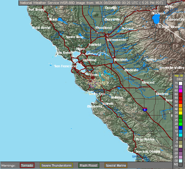
Enlarge
|
USGS Gaging Station
 This houses the electronic equipment which continuously records certain river and environmental parameters. These data are transmitted in real
time to the USGS National Water Information System
(NWIS).
This houses the electronic equipment which continuously records certain river and environmental parameters. These data are transmitted in real
time to the USGS National Water Information System
(NWIS).
|
Latest Gage Readings*
*Gage records are provisional and subject to revision. |
River Flow
(Historic peak: 5 Jan 1978, 10,700 ft³/s) |
Stage
(Streambed: 3.2 ft) |
| 2009-08-12 20:15 PDT |
19 ft³/s (graph)
|
4.47 feet (graph)
|
Image animations require:

|


)