
 Feeds & Data
ShakeMaps
ShakeMap is a product of the U.S. Geological Survey Earthquake Hazards Program in conjunction with regional seismic network operators. ShakeMap sites provide near-real-time maps of ground motion and shaking intensity following significant earthquakes. These maps are used by federal, state, and local organizations, both public and private, for post-earthquake response and recovery, public and scientific information, as well as for preparedness exercises and disaster planning.
Networks producing ShakeMaps
Click a network name to view a list of events, or on an image to view the event
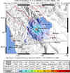
S California
14499528N California

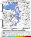
71262476Pacific NW
07022240Nevada

2009201_288313Utah

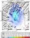
1000004030Hawaii

00034187Alaska
10004254Global
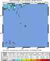
2009kfcp
Last 10 ShakeMaps from any Network
A list of all ShakeMaps is available in the ShakeMap Archive
| Mag | Name/Epicenter | Date | Time | Lat | Lon | Network | Event ID |
|---|---|---|---|---|---|---|---|
| 3.5 | 5.7 mi WSW of Ocotillo Wells, CA | Aug 12 2009 | 23:49:04 UTC | 33.098 | -116.215 | S California | 14499528 |
| 6.7 | IZU ISLANDS, JAPAN REGION | Aug 12 2009 | 22:48:51 UTC | 32.816 | 140.382 | Global | 2009kfcp |
| 5.6 | MINDANAO, PHILIPPINES | Aug 12 2009 | 20:04:25 UTC | 6.046 | 126.356 | Global | 2009kfb7 |
| 5.5 | CATAMARCA, ARGENTINA | Aug 12 2009 | 18:00:51 UTC | -27.822 | -66.569 | Global | 2009kfbn |
| 5.5 | SOUTH SANDWICH ISLANDS REGION | Aug 12 2009 | 14:50:16 UTC | -57.681 | -25.331 | Global | 2009kfa9 |
| 3.9 | 33.1 miles W of Talkeetna | Aug 11 2009 | 15:31:55 UTC | 62.246 | -151.123 | Alaska | 10004254 |
| 3.9 | 222.1 miles SE of Adak | Aug 11 2009 | 00:00:31 UTC | 49.888 | -172.648 | Alaska | 10004205 |
| 6.4 | NEAR THE SOUTH COAST OF HONSHU, JAPAN | Aug 10 2009 | 20:07:07 UTC | 34.778 | 138.276 | Global | 2009kdb4 |
| 7.6 | ANDAMAN ISLANDS, INDIA REGION | Aug 10 2009 | 19:55:39 UTC | 14.013 | 92.923 | Global | 2009kdb2 |
| 5.6 | NEAR NORTH COAST OF NEW GUINEA, P.N.G. | Aug 10 2009 | 17:46:27 UTC | -3.127 | 143.179 | Global | 2009kdbi |
