March 2009
STATION INFORMATION DATA
SHEET - NORTHEAST NEVADA (WFO ELKO)
Map Disclaimer
COMMUNITY DESCRIPTION: Elko is located on the Humboldt River in northeastern Nevada along Interstate
80. It is situated 230 miles west of Salt Lake City, 240 miles southeast of
Boise, and 290 miles east of Reno. It is a thriving community of 25,000
residents with a metro population of 50,000 including towns of Spring Creek,
Lamoille, and Carlin. Elko is the county
seat of Elko County, the fourth largest
county in the country with an area around the size of Massachusetts and Connecticut combined.

Spring Creek, a bedroom community
adjacent to Elko, as viewed from the Elko Hills.
The Ruby Mountains can be seen in the distance.
There are a wide variety of services available in
Elko, including many shopping facilities and fine stores. There are also two
movie theaters with a total of 9 screens, as well as several casinos. In
addition, several new stores are planned in the near future.

Downtown Elko
Elko has several options for dining. Three famous Basque restaurants are well known
for their steaks and family style meals. All together, there are 34
restaurants, with fare including sushi, wings, Mexican food, pizza, and fine
cuisine.
The city has an excellent Convention Center with
a one-thousand seat main theater where concerts, including the Elko Community
Concert series, and other public functions are held. The Northeastern Nevada Museum is a world-class museum
with history, geology, and art exhibits, in addition to the Wanamaker Wildlife
Exhibit and the Spring Creek Mastodon Exhibit. The Western Folklife Center is dedicated to the
preservation and presentation of the traditional cultures of the American West.
Sherman Station, which houses the Visitor’s Center and Chamber of Commerce,
includes a ranch house and five outbuildings built between 1880 and 1903. There are two libraries in town, a public
library and the Great Basin College library, which is also
open to the public.

An original Pony Express station
displayed at the Northeastern Nevada Musuem
Elko is home to the world famous Cowboy Poetry Gathering
which is celebrated annually in late January.
Other annual events include the Motorcycle Jamboree and Mining Expo in
June, the Basque Festival in July, the Elko County Fair in August, and the Ruby
Mountain Balloon Festival in September. The fair includes 4-H exhibits, stock
horse competitions, roping, branding, barrel racing, and 6 days of thoroughbred
and quarter horse racing. Dozens of civic organizations call Elko home,
including Rotary International, Kiwanis, Lions Club, VFW, Knights of Columbus,
and Toastmasters International.
There are several radio stations in Elko (AM and
FM), and a TV station, KENV, which is affiliated with NBC. Cable and satellite TV offer programming from
Salt
Lake City and Reno. There is one daily newspaper, the Elko Daily
Free Press.
Mining is the largest industry in the Elko area,
with gold being the principal product.
Cattle ranches play an important role in the economy as well, and hay is
the chief agricultural product. The
casinos and mines employ a significant number of people in the area. Several banks, savings and loan associations,
and credit unions are located in Elko.
The crime rate in Elko is low and police
services are good. The State Police and the Sheriff’s Office have facilities in
Elko, in addition to the Elko City Police Department.
RECREATION: Sports and recreational
facilities in Elko include a large outdoor public pool, an Olympic size indoor
pool, several tennis courts, and softball fields. The 1,500 seat Horse Palace Equestrian Center in Spring Creek
provides a central meeting place for equine activities. There are two 18-hole
golf courses with full club houses, Ruby View and Spring Creek Golf Courses. Also, for fitness enthusiasts, there are a
few health clubs in the area.
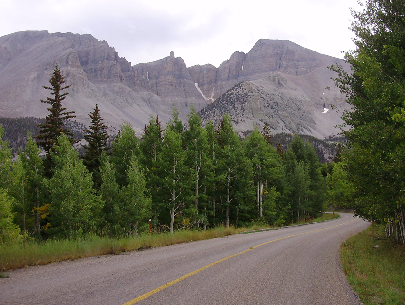
Looking further afield, the Elko forecast area
is in wide-open country with terrain ranging from high desert at 4000-5000 feet
to mountain ranges that rise to more than 11,000 feet. The area has abundant outdoor activities with
good fishing, hunting, golfing, snowmobiling, hiking, camping, mountain biking, and limited skiing. The beautiful Ruby Mountains, part of the
Humboldt-Toiyabe National Forest, can be accessed
about 30 miles southeast of Elko and provide a setting for many outdoor
activities.

Alpine lakes contrast with alkali flats
in this view from Liberty Peak in the Ruby Mountains.
In the Ruby Valley just east of the
mountains, many large cattle ranches (1000+ head) line the main road. Ruby Marshes, sometimes called Ruby Lake (yes, in the desert)
can be found at the south end of the valley and provide excellent trout and
large mouth bass fishing. It has its own
fish hatchery, operated by the U.S. Forest Service, and a campground. Wildhorse Reservoir,
60 miles north of Elko, has excellent trout and yellow perch fishing even
through the ice in the winter. South Fork Reservoir, 20 miles south of Elko,
affords the opportunity for recreational boating and camping, and fishing is
popular as well. Great Basin National Park is in the southeast
corner of the forecast area; Wheeler Peak, the park’s highest
mountain, rises to over 13,000 feet. The
park contains four modern campgrounds; guided tours of Lehmann Caves, one of the park’s main
attractions, are offered year-round.

Lehman Caves in Great Basin National Park.
Lamoille Canyon in the Ruby Mountains offers some of the
finest hiking trails and views in the entire western United States. The canyon road ascends from 6,000 feet, near
the town of Lamoille, a distance of 12 miles
to the trailhead parking lot at 8,500 feet.
From there several trails ascend to between 10,000 and 11,000 feet,
offering spectacular views of alpine lakes.
There are also two camping areas and two picnic areas, all with full
facilities. In the winter there is heli-skiing, cross
country skiing, snowshoeing, and snowmobiling.

The view up Lamoille Canyon; the canyon’s glacial origins are evident
from its distinct U-shape.
PHYSICAL: A series of mountain
ranges run from north to south across northeastern and central Nevada. The Ruby Mountains and East Humboldt Range
southeast and east of Elko have the highest peaks in the local area with several
reaching more than 11,000 feet. There
are aspen, whitebark and limber pine, fir, and spruce
at the higher elevations in the mountains, while juniper and pinyon pine cover many of the lower slopes, and sagebrush
dominates the valley floors. There are
also several small alpine lakes.
The Jarbridge
wilderness area is located in north-central Elko County near the Idaho border, and is another
of the few locations in the State relatively widespread forest cover. This wilderness area contains a few small
lakes with mountain peaks towering over 10,000 feet. The highest point in the County Warning Area (CWA)
is Wheeler Peak in Great Basin National Park at an elevation over 13,000 feet.
Wheeler Peak, the highest mountain in
the Elko County Warning Area - 13,065 feet above sea level.
CLIMATE: The elevation of Elko Regional Airport is 5,050 feet. Most of the city is between 5,000
and 5,200 feet. The highest
sections of town rise to around 5,300 feet.
Because of the high elevation, proximity to the
mountains, and semi-arid climate, there is typically a wide range between the
daily high and low temperatures. Strong radiative cooling after sunset leads to cool nights, even
in summer. Normal precipitation is
light, averaging around 9.59 inches of liquid precipitation each year. Rainfall is especially light in the summer
months when the precipitation falls mostly in light showers. Most of the precipitation that falls during
the winter months is in the form of snow.
Snowfall in the city of Elko averages 37 inches annually,
but significantly greater snowfall usually occurs in portions of Spring Creek
adjacent to the Ruby Mountains.

An early October snowfall at the base of
the Ruby Mountains.
CHURCHES: Religious organizations for most faiths are
available in Elko, including Baptist, Catholic, LDS, Episcopal, Lutheran,
Presbyterian, Seventh Day Adventist, Assembly of God, and United Methodist.
MEDICAL FACILITIES: The modern Northeastern Nevada Regional Hospital, located in Elko,
services all of northeast Nevada, and several medical
clinics are available as well. They
provide all normal medical services. Several
dental and other health facilities are also available.
EDUCATIONAL FACILITIES: The school district is excellent. Between Elko and Spring Creek, there are five
elementary schools, two junior high / middle schools, and two high schools. Elko also has two private schools and one
school for the mentally handicapped.
Great Basin College, with 3,500 students,
has a beautiful, modern campus, and offers both associate and bachelor degrees
in agriculture, business, computer sciences, education, health sciences,
technology, and other disciplines. Many events are held on campus each year,
including the Foreign Film Festival in the spring.
HOUSING: Housing is readily available with
normal-sized homes ranging from $150,000 to $250,000, and larger homes from $250,000
to $350,000. Custom built homes may take
several months to finish. Also available
are double-wide mobile homes on a one or two acre lot for $75,000 to $150,000. Rental units are available with the average
cost of $500 to $800 per month for apartments, and $1,200 to $2,000 for houses.
TRANSPORTATION: Interstate 80 connects Elko with Salt Lake City and Reno. Mountain City Highway (Nevada State Highway 225)
runs north from Elko to Boise. Daily AMTRAK service
is available, west to Emeryville (San Francisco) and east to Chicago. Greyhound Bus Line also provides daily service.
Elko Regional Airport terminal.
Elko has a very modern airport, with SkyWest Airlines
flying 4 round trips from Elko to Salt Lake City daily.
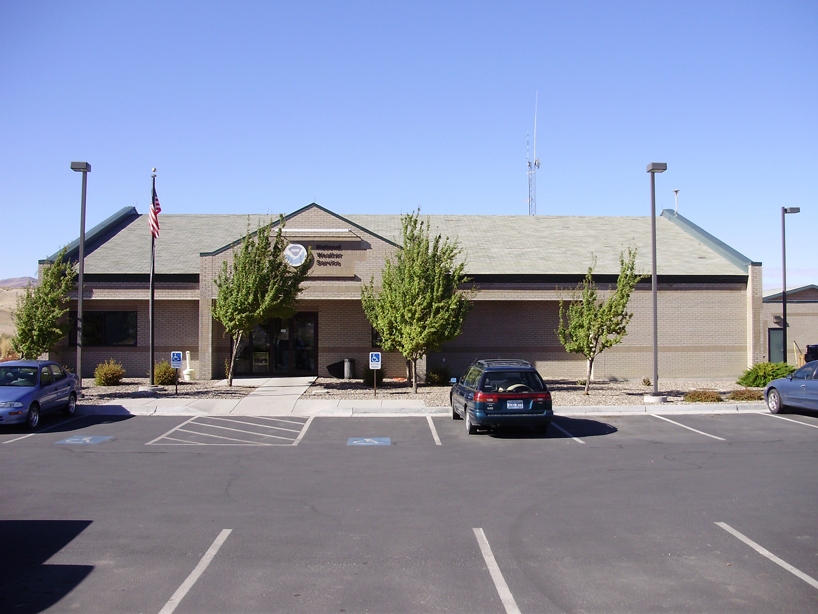
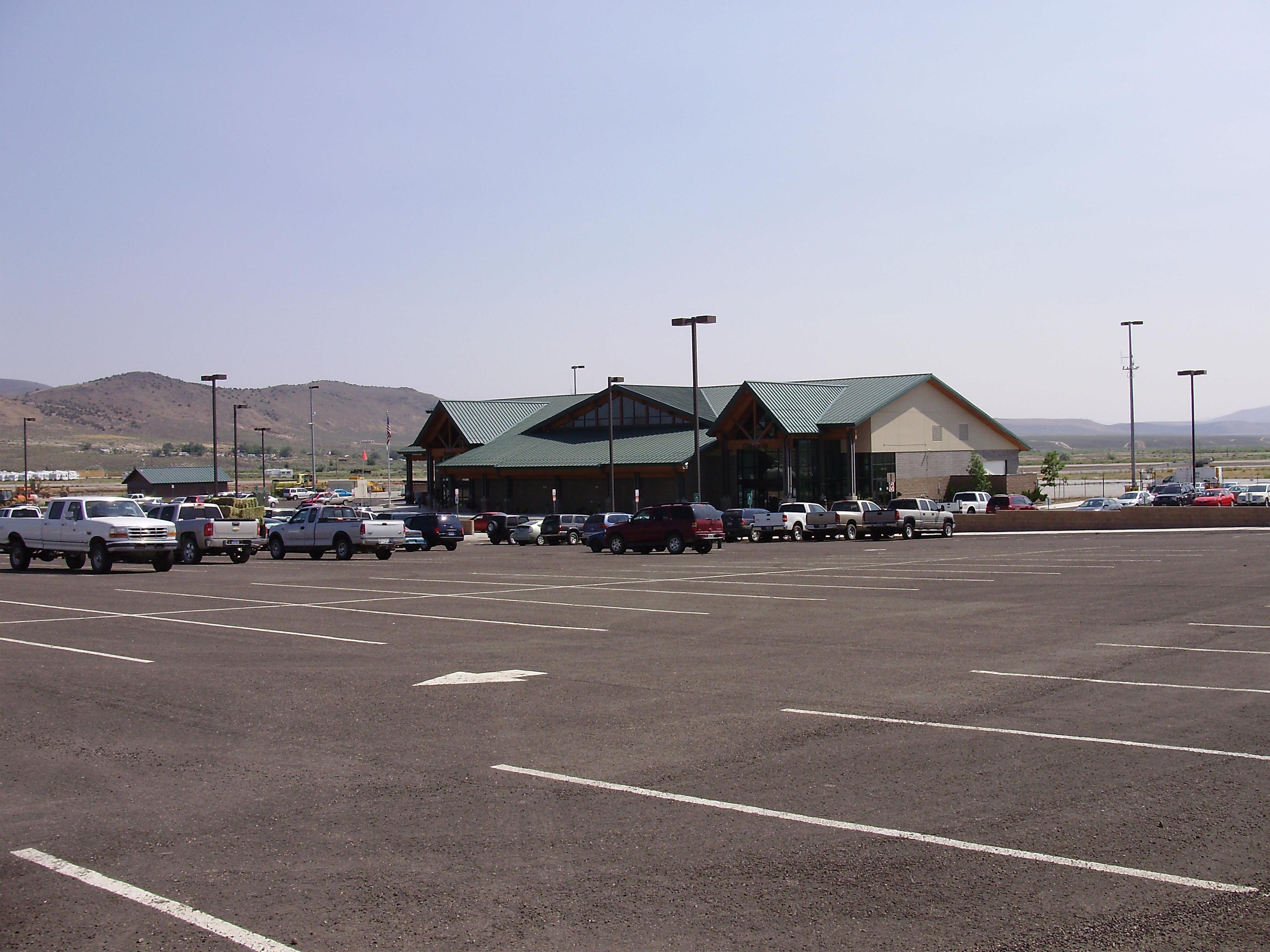
Weather Forecast Office Elko.
STATION PROGRAM: The WFO in Elko is a very pleasant place to
work, and the high desert and mountain weather is challenging to forecast. The lower elevations in the CWA receive 5 to
11 inches of precipitation annually, with approximately half in the form of
snow. The average annual snowfall in the
valleys ranges from about 20 to 50 inches, depending on elevation and proximity
to the mountains. The higher elevations above
10,000 feet can receive as much as 300 inches of snow. Summers are warm and humidity is quite low,
but monsoonal thunderstorms occur at times, particularly across the southern
portion of the CWA. Flash flooding is
sometimes a concern in the diverse terrain in the Elko warning area, as well as
the occasional severe thunderstorm with strong winds.

The Elko Weather Forecast Office and
adjacent buildings. The upper-air building can be seen on the far
right.
WFO Elko broadcasts over seven NOAA Weather
Radio transmitters and is part of the national upper air observing network. The CWA spans almost 55,000 square miles of
mostly rural terrain.

Physical map of the Elko WFO County
Warning Area, which consists of Humboldt, Elko, Lander, Eureka, White Pine and
northern Nye counties in northeastern and central Nevada. The main communities and highways are also
depicted.
The WFO prepares gridded forecasts, short
term forecasts, fire weather forecasts, four TAF’s,
various climatological and hydrometeorological
forecasts and summaries, and has an expansive cooperative observer and spotter
program.

The Winnemucca Airport Automated Surface Observing
System (ASOS), one of five ASOS units located within the Elko CWA.
The Winnemucca Airport Automated Surface Observing
System (ASOS), one of five ASOS units located within the Elko CWA.
Electronics technicians maintain several of the
radio transmitters, the Battle Mountain Weather Surveillance Radar 1988 Doppler
Radar (WSR-88D), and four Automated Surface Observing System (ASOS) units
located at the Elko, Ely, Winnemucca and Eureka airports. A fifth ASOS unit located at Tonopah Airport is maintained by staff
from WFO Las Vegas.

KLRX WSR-88D radar, located in the Sheep Creek Range near Battle Mountain, Nevada