| 1100 |  |
First rain band from Hurricane Isobel making landfall. |
Newport, North Carolina WFO Radar 2003 September 18 0330 UTC |
1101 |  |
First rain band from Hurricane Isobel making landfall. |
Wakefield, Virginia WFO Radar 2003 September 18 0330 UTC |
1102 |  |
Eyewall imaged to southeast as Hurricane Isobel continues moving ashore. |
Newport, North Carolina WFO Radar 2003 September 18 1022 UTC |
1103 |  |
Rainbands from Hurricane Isobel seen from Wakefield, Virginia, radar. |
Wakefield, Virginia WFO Radar 2003 September 18 1022 UTC |
1104 |  |
Rainbands and eyewall of Hurricane Isobel seen in its entirety from Newport, North Carolina, radar. |
Newport, North Carolina WFO Radar 2003 September 18 1343 UTC |
1105 |  |
Rainbands from Hurricane Isobel seen from Sterling, Virginia, radar. |
Sterling, Virginia WFO Radar 2003 September 18 1345 UTC |
1106 |  |
Rainbands from Hurricane Isobel seen from Wakefield, Virginia, radar. |
Wakefield, Virginia WFO Radar 2003 September 18 1342 UTC |
1107 |  |
Eyewall crossing the Outer Banks southwest of Cape Hatteras. Hurricane Isobel. |
Newport, North Carolina WFO Radar 2003 September 18 1649 UTC |
1108 |  |
Eyewall crossing the Outer Banks southwest of Cape Hatteras. Hurricane Isobel. |
Wakefield, Virginia WFO Radar 2003 September 18 1652 UTC |
1109 |  |
Rainbands from Hurricane Isobel seen from Sterling, Virginia, radar. |
Sterling, Virginia WFO Radar 2003 September 18 1654 UTC |
1110 |  |
Eyewall deteriorating after Hurricane Isobel starts moving inland. |
Newport, North Carolina WFO Radar 2003 September 18 1821 UTC |
1111 |  |
Sunrise effect and birds leaving roosting area just east of Baltimore. Birds spread out in all directions while heading towards foraging areas. |
Sterling, Virginia WFO Radar 2004 August 26 1038 UTC |
1112 |  |
A razor-thin squall line in the Channel Islands. |
San Diego, California WFO Radar 2005 September 20 0327 UTC |
1113 |  |
First in a sequence of thunderstorms over Lake Michigan. |
Green Bay, Wisconsin WFO Radar 2005 September 13 2350 UTC |
1114 |  |
The first rain band from Hurricane Frances as seen from the Melbourne radar. |
Florida, Melbourne WFO Radar 2004 September 4 0102 UTC |
1115 |  |
Strong storms with outflow boundary as seen from the Goodland, Kansas radar. |
Goodland, Kansas WFO Radar 2005 August 26 0130 UTC |
1116 |  |
The eye of Hurricane Katrina passing to the south of Miami. |
Florida, Miami WFO Radar 2005 August 26 0128 UTC |
1117 |  |
Strong storms over Lake Michigan and eastern Wisconsin moving to the east. |
Green Bay, Wisconsin WFO Radar 2005 September 13 2354 UTC |
1118 |  |
Strong storms over Lake Michigan and western Michigan moving to the east. This storm system took a little over an hour to cross Lake Michigan. |
Gaylord, Michigan WFO Radar 2005 September 14 0113 UTC |
1119 |  |
Thunderstorms over eastern Kansas and western Missouri. |
Kansas City, Missouri WFO Radar 2005 September 13 2306 UTC |
1120 |  |
Thunderstorms over western Nebraska and northwest Kansas. See image wea01277. |
North Platte, Nebraska WFO Radar 2005 August 26 0141 UTC |
1121 |  |
Hurricane Opelia brushing the coast of the Carolinas. |
Wilmington, North Carolina WFO Radar 2005 September 14 1048 UTC |
1122 |  |
Hurricane Opelia heading northeast passing just offshore from Cape Fear. |
Newport, North Carolina WFO Radar 2005 September 15 0234 UTC |
1123 |  |
The western edge of Hurricane Katrina as seen from Lake Charles. |
Lake Charles, Louisiana WFO Radar 2005 August 29 0923 UTC |
1124 |  |
Hurricane Katrina making landfall near Southwest Pass, Louisiana. |
Mobile, Alabama WFO Radar 2005 August 29 0923 UTC |
1125 |  |
Hurricane Katrina making landfall near Southwest Pass, Louisiana. |
New Orleans, Louisiana WFO Radar 2005 August 29 0921 UTC |
1126 |  |
Hurricane Rita churning in the Gulf of Mexico south of Lake Charles, Louisiana. |
Lake Charles, Louisiana WFO Radar 2005 September 23 2017 UTC |
1127 |  |
The western bands of Hurricane Rita churning in the Gulf of Mexico. |
Houston, Texas WFO Radar 2005 September 23 2017 UTC |
1128 |  |
Hurricane Rita as seen from Miami radar. |
Miami, Florida WFO Radar 2005 September 20 1101 UTC |
1129 |  |
Hurricane Rita as seen from Key West radar. |
Key West, Florida WFO Radar 2005 September 21 0034 UTC |
1130 |  |
The outer rainband from Hurricane Rita as seen from the Mobile radar. |
Mobile, Alabama WFO Radar 2005 September 23 0006 UTC |
1131 |  |
Hurricane Rita approaching landfall along the Texas-Louisiana border. |
Lake Charles, Louisiana WFO Radar 2005 September 24 0138 UTC |
1132 |  |
Hurricane Rita making landfall near Beaumont, Texas. |
Lake Charles, Louisiana WFO Radar 2005 September 24 0742 UTC |
1133 |  |
The United States Weather Bureau Building in Washington, D.C. Frontispiece of "Meteorology" by Willis Milham, 1912 |
1910? |
1134 |  |
A Weather Bureau office - location and date unknown |
Ca. 1900 |
1135 |  |
The Weather Bureau Forecast Office |
Washington, D.C. 1926 |
1136 |  |
Unidentified station chief and colleague at a local forecast office |
Ca. 1900 |
1137 |  |
The local forecast office at Buffalo, New York |
January, 1899 |
1138 |  |
Unidentified personnel at a Weather Bureau office |
Ca. 1900 |
1139 |  |
Hard at work in the teletype center - note teletype machines behind personnel Women's first opportunities in meteorology occurred as a result of WWII. |
Ca. 1944 |
1140 |  |
Plotting upper-air maps Women's first opportunities in meteorology occurred as a result of WWII |
1944 Circa |
1141 | 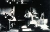 |
Hard at work in an unidentified Weather Bureau office. |
|
1142 |  |
At work in an unidentified Weather Bureau office. |
1910 Circa |
1143 |  |
Unidentified Weather Bureau employees discussing some weather theory |
|
1144 |  |
Regional office training for new Weather Bureau employees Women's first opportunities in meteorology occurred as a result of WWII |
1944 Circa |
1145 |  |
United States Weather Bureau Headquarters in Washington, D. C. |
1910? |
1146 |  |
Left: Exterior view of the Headquarters Building of the U. S. Meteorological Service of the United States Signal Service. Right: A meteorologist reading a barometer. In: Frank Leslie's Illustrated Newspaper, N. Y. , Vol. 50, Supplement, May 1, 1880. Call Number M/0203 U 58m. |
1880 |
1147 |  |
The instrument room on the top floor of the U. S. Meteorological Service of the United States Signal Service. In: Frank Leslie's Illustrated Newspaper, N. Y. , Vol. 50, Supplement, May 1, 1880. Call Number M/0203 U 58m. |
1880 |
1148 |  |
Left: Arranging the arrows on the map. Right: Photographing the temperature by lamp light. At the headquarters of the Meteorological Service of the United States Signal Service. In: Frank Leslie's Illustrated Newspaper, N. Y. , Vol. 50, Supplement, May 1, 1880. Call Number M/0203 U 58m. |
1880 |
1149 |  |
Arrangement of the wind instruments on the roof of the Headquarters Building of the Meteorological Service of the United States Signal Service. In: Frank Leslie's Illustrated Newspaper, N. Y. , Vol. 50, Supplement, May 1, 1880. Call Number M/0203 U 58m. |
1880 |

