|
Research Project:
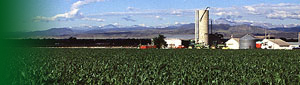
Evaluation of Conservation Practice Effectiveness in Water Quality Protection in the Choptank River Watershed
Location: Hydrology and Remote Sensing Laboratory
Project Number: 1265-12130-002-05
Project Type:
Specific Cooperative Agreement
Start Date: Feb 25, 2005
End Date: Nov 30, 2009
Objective:
Establish benchmark assessment of NRCS/FSA Conservation Programs for application of REMM and AnnAGNIPS models to provide watershed-scale assessment of conservation practices in the Choptank River Watershed.
The main goal of this project is to quantify the ability of wetlands, along an alteration gradient, to reduce nutrient loading in streams, the impact of wetland alteration on ecosystem functioning in adjacent streams, and to develop a landscape analysis tool, which can be used to estimate wetland services and guide management decisions.
Approach:
This project combines the use of historical water quality databases that exist for the Choptank River Watershed with current monitoring within specific sub-watersheds with varying percentages of CRP and CREP installations. This data will be used to build a functioning watershed model to evaluate the effectiveness of conservation practices such as CRP and CREP. A set of 15 subwatersheds (a series of 2nd and 3rd order streams) will be monitored under base flow and storm conditions for nutrients and other water quality indicators. GIS maps with high resolution datasets for land use, soil types, and other related water quality measurable endpoints will be used to construct the model.
This project will employ a multi-disciplinary, multi-scale approach to meet project goals in the headwaters of the Choptank River Watershed, including depressional (e.g., Delmarva bays), flats, and/or riverine wetlands. A review of past research and data collected for this project and simultaneous USGS projects will be used to build a conceptual model of ground water flow for wetlands and hydrologically linked streams in different geomorphologic settings. Information on hydrology, water chemistry, and ecological functioning will be collected at typical wetland sites, divided equally between prior-converted (drained) wetlands on cropland, restored wetlands, particularly hydrologically restored wetlands, and relatively undisturbed wetlands. Remotely sensed imagery, geographic information system (GIS) technology, and simple biogeochemical relationships will be used to create a predictive landscape analysis tool, designed to support adaptive management. The potential of water quality models for the estimation of the cumulative impact of conservation practices (e.g., controlled drainage structures, cover crops, and riparian buffers) is currently being assessed by the Choptank Conservation Effects Assessment Project (CEAP).
|
|
|
|