|
|
|
Metadata
|
|
ID
|
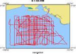
K-1-94-HW
|
|
Abstract
|
United States Army Corps of Engineers. Chief Scientists:
Mike Torresan, Monty Hampton. Geological and Geophysical data
(bathymetry, underwatertelevision, underwatercamera,
3dot5khz, GPS, YoNav) of field activity K-1-94-HW in Mamala
Bay, Offshore Honolulu, Oahu, Hawaii from 05/10/1994 to
05/16/1994
|
|
Organization
|
United States Army Corps of Engineers
|
|
Project/Theme
|
South Oahu Deep Ocean Disposal Site Survey
|
|
National Plan
|
Environment
|
|
Chief Scientist
|
Mike Torresan
Monty Hampton
|
|
Activity Type
|
Geological and Geophysical
|
|
Platform
|
Kila
|
|
Area of Operation
|
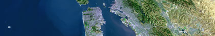
Mamala Bay, Offshore Honolulu, Oahu, Hawaii
|
|
Location map
|
|
|
Bounding Coordinates
|
21.31590
-158.02194 -157.79750
21.17743
|
|
Dates
|
05/10/1994 (JD 130) to 05/16/1994 (JD 136)
|
|
Analog Materials
|
list
|
|
Index map

|
|
|
Crew
|
|
Mike Torresan
|
Chief Scientist, USGS Western Region
|
|
Monty Hampton
|
Chief Scientist, USGS Western Region
|
|
|
Equipment Used
|
|
bathymetry
|
|
underwatertelevision
|
|
underwatercamera
|
|
3dot5khz
|
|
GPS
|
|
YoNav
|
|
|
Purpose
|
|
Employ video and still photography, and high-resolution subbottom
|
|
profiling to groundtruth and quantify the sidescan sonar mosaic and acoustic
|
|
data collected in 1993 of the US Army Corps of Engineers South Oahu Deep Ocean
|
|
Dredged Material Disposal Sites. We are attempting to acoustically characterize
|
|
the anthropogenic effects on the seafloor and near-surface substrate over the
|
|
disposal sites. Through photography and bottom sampling we can quantify the
|
|
Sonar Mosaic and acoustics collected in the 1993 field operations.
|
|
|
Summary
|
|
Nearly 100 hours of underwater video and still photography, and over 200 km of high-resolution 3.5 kHz subbottom profiles over the deep ocean disposal sites.
|
|
|
Notes
|
|
|
Publications
|
|
Hampton, M.A., Torresan, M.E., Barber, J.H., Jr., Wong, F.L., Chezar, H., Gowen, M.H.,
|
|
and Chase, T.E., 1995, Multimedia survey of the Mamala Bay sea floor, Hawaii: Geological
|
Society of America Abstracts with Programs, v. 27, no. 6, p. 201.
|
|
|
Torresan, M.E., Barber, J.H., Jr., Hampton, M.A., Dartnell, Peter, Chezar, Henry, McLaughlin,
|
|
M.W., Gowen, M.H., Zink, L.L., and Dadey, K.A., 1994, Ground truthing high-backscatter dredged
|
|
material deposits in Mamala Bay, Honolulu, Hawaii: American Geophysical Union Eos, Transactions,
|
v. 75, no. 44, Supplement, p. 319.
|
|
|
Torresan, Michael, 1995, Final report: acoustic mapping of dredged material disposal
|
|
sites and deposits in Mamala Bay, Honolulu, Hawaii: U.S. Geological Survey Open-File
|
Report 95-17, 53 p.:
|
http://geopubs.wr.usgs.gov/open-file/of95-17/
|
|
|
Torresan, M.E., Hampton, M.A., Barber, H.H. Jr., and Wong, F.L., 1995,
|
K1-95-HW: Cruise Report 1995 - Preliminary results., U.S. Geological Survey Open-File Report 95-839,
|
|
http://geopubs.wr.usgs.gov/open-file/of95-839
|
|
|
Got Help?
|
For K-1-94-HW, we would appreciate any information on -- contract, days at sea, dive count, funding, information specialist, information to be derived, kms of navigation, NGDC Info, owner, ports, project number, scanned materials, seismic description, station count, station description, submersible, tabulated info.
|
|