|
|
|

|
Integrated Data Viewer (IDV)
The Integrated Data Viewer (IDV) from Unidata is a Java(TM)-based software framework for analyzing and visualizing geoscience data. The IDV brings together the ability to display and work with satellite imagery, gridded data, surface observations, balloon soundings, NWS WSR-88D Level II and Level III radar data, and NOAA National Profiler Network data, all within a unified interface. more >
|
|
|
|
|
|
|
|
Examples of IDV Display Capabilities
|
|
Developed using Java, VisAD and other component libraries, the IDV emphasizes interactive 3D visualization and integration of diverse data types:
|
|
|
|
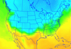
Plan Views
Display plain view horizontal 2D map data or cross-sections of 3D data using the IDV.
|
|
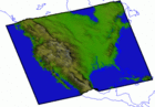
3D Surface
The IDV supports isosurface, topography, and 2D data draped over topography displays.
|
|
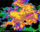
Satellite & Radar Imagery
Create displays from Satellite and NWS WSR-88D Level III Radar data using the IDV.
|
|
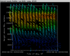
Profiler Winds
The IDV provides a Profiler Time/Height plot, Profiler Station plot, and a Profiler 3D view for displaying wind data.
|

|
Globe Display
In the Globe Display version of the IDV, the displays and maps are projected onto a spherical globe.
|
|
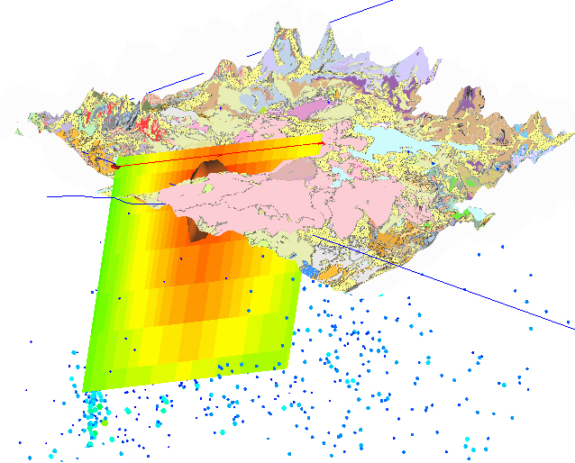
GEON IDV
The GEON IDV is an extension of the IDV created by UNAVCO to meet the needs of the solid earth science community.
|
|
|
More examples of IDV display capabilities:
• List of Display Types
• IDV Gallery of Images
• Quicktime Movies
|
|
|
|