 |
 | |
  | |
|
|
|
|
Montezuma Castle National Monument
Directions
|
|
|
directions includes: | Maps
|  | | | |
|
|
| |
 |
 |
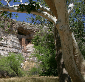
| NPS | | The trails at Montezuma Castle National Monument take your through a tranquil glade of Arizona sycamores and provide spectacular views of this majestic ruin. |
 |
Montezuma Castle
Marvel at the 1,000 year old legacy of the Sinagua as you explore the ruins at Montezuma Castle National Monument.
A paved, 1/3 mile loop trails takes you through a tranquil sycamore glade and past the ancient cliff dwellings of a people surprisingly similar to ourselves.
Directions: Follow I-17 to exit 289 (90 minutes north of Phoenix, 45 minutes south of Flagstaff).
Drive east (through two traffic circles) for approximately 1/2 mile to the blinking red light. Turn left on Montezuma Castle Road.
|
 |
| NPS | | The short trail to the outlet follows the path of a 1,000 year old irrigation ditch. |
 |
Montezuma Well
Exploring Montezuma Well reveals a place like no other in the world. Take your time and discover the tranquility of a site that has served as an oasis for wildlife and people for thousands of years.
Directions: Follow I-17 to exit 293 (4 miles north of the exit for Montezuma Castle). Continue through the towns of McGuireville and Rimrock, following the signs for four miles to the entrance to the Well. There is no fee to enter Montezuma Well.
|
|  |  |

|
 |
|
|
|
|
|
 |
|
Did You Know?
The battle of Palo Alto occurred before war had been declared between the United States and Mexico. The battle took place on May 8, 1846, the U.S. Congress declared war on May 13.
|
|
|
|
Last Updated: May 29, 2007 at 17:51 EST |


