 |
 | |
  | |
|
|
|
|
Olympic National Park
Rivers and Lakes
|
|
|
|
|
| |
 |
 |
| Planned removal of two dams on the Elwha River will open up 70 miles of pristine habitat to salmon again. |
 |
Water defines Olympic National Park. In cloud form it delivers abundant rain and snow. As frozen glaciers it sculpts the peaks. In snow-melt rivulets it waters mountain meadows then feeds powerful rivers rushing to the sea. Alpine tarns perch on peaks and several huge lakes lie in the lowlands. These streams, rivers and lakes are a circulatory system—life-blood of the park's diversity.
A Wheel of Rivers
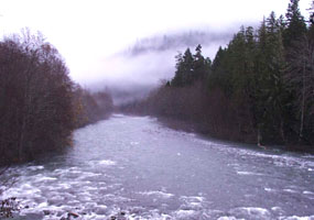
Mount Olympus, the park's highest peak, is in the middle of the range. Rivers radiate out from the central mountains like spokes on a wheel. On the park's west side, valleys are broad and U-shaped and rivers meander over wide floodplains. On other sides, the rivers are often constricted into narrow, steep-walled valleys.
Highways of Life
With protected headwaters, these are healthy, dynamic watersheds where natural processes like flooding, log jams, and nutrient cycling prevail. To learn more about the watery wealth of Olympic, click on the links below.
|

|
| Mount Duckabush and subalpine slope reflected in the still water of Hart Lake in the headwaters of the Duckabush River. |
|
|  |  |

|
 |
|
|
|
|
|
 |
|
Did You Know?
Olympic National Park protects 73 miles of wild Pacific coast. Tidepools, sandy beaches and rocky cliffs can all be found here.
|
|
|
|
Last Updated: August 15, 2006 at 15:29 EST |


