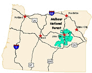
Malheur National Forest
| Grant County Chamber of Commerce | |
| Harney County Chamber of Commerce | |
| Evaluate Our Service We welcome your comments on our service and your suggestions for improvement |
Malheur National Forest (541) 575-3000 |
|
|
|
Welcome
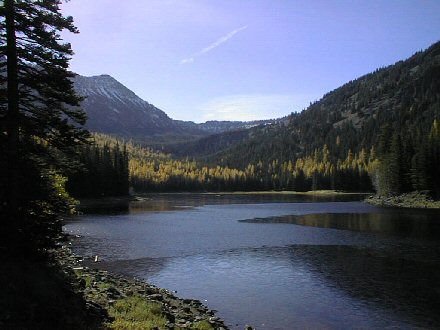
The 1.7 million acre Malheur National Forest is located in the Blue Mountains of Eastern Oregon. The diverse and beautiful scenery of the forest includes high desert grasslands, sage and juniper, pine, fir and other tree species, and the hidden gems of alpine lakes and meadows. Elevations vary from about 4000 feet (1200 meters) to the 9038 foot (2754 meters) top of Strawberry Mountain. The Strawberry Mountain range extends east to west through the center of the Forest. Hunter InformationACCESS OPENS ON MURDERERS CREEK UNITHunting Update on Murderers Creek Unit Access (As of 9/27/2007 Adobe PDF 24kb) Shaketable Fire Area Access Map (As of 9/27/2007 Adobe PDF 276kb)
|
Keep informed of exciting happenings and opportunities on your National Forests by signing up for the National Forest Foundation tree-mail monthly e-newsletter.
|
![[Photo] Tree on fire](images/tr-flames2.jpg) Fire Information
Fire Information

USDA Forest Service - Malheur National Forest
Last Modified: Monday, 06 April 2009 at 18:18:57 EDT