|
USGCRP
Home |
| Search |
|
Updated 17 September 2008
|
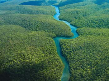
The
Global Water Cycle |
|
USGCRP
Home |
| Search |
|
Updated 17 September 2008
|
The
Global Water Cycle |
|
The Global Water CycleNear-Term Plans Archived News Postings [June 2000 - July 2005] CCSP / USGCRP Water Cycle Working Group Members
Past Accomplishments:
Climate Change Science Program. FY 2008 Scientific Research Budget by USGCRP Research Element |
HIGHLIGHTS OF PLANS FOR FY 2009The Global Water Cycle research element continues to pursue important long-term priorities. For example, insights into the formation and behavior of clouds and precipitation, including better characterizations of the phase changes of water in clouds and the phases and onset of precipitation, are emerging from field campaigns and model studies and will be promoted in continuing activities. Water vapor and cloud radiation feedback are considered a critical part of global water cycle studies that need to be addressed to reduce uncertainties associated with climate change projections. The predictability of regional precipitation is another topic of vital interest: It will be assessed and better understood by ongoing diagnostic and modeling studies that identify the connections between regional- and global-scale phenomena, land surface conditions such as soil moisture and water table fluctuations, and the interface fluxes of energy and heat between the atmosphere and the land surface-vegetation-hydrology combination. Preliminary analyses from recent studies show promise of leading to earlier (and more accurate) predictions, improved ability to assess hazards and risks of extremes such as floods and droughts, and more efficient water resource management. In FY 2009, continuing U.S. and global observations, field campaigns and experiments, improvements to data integration and analysis systems, diagnostic and predictive model development, and applications to decision-support systems will be priorities under the CCSP Global Water Cycle program. A fundamental objective is to ensure that observational capability is enhanced and improved, and that the data assimilation and modeling/prediction systems are more reliable and accurate at the point of application. Several promising results from the past years of research will be further explored with an aim to transfer this research knowledge to operational applications that provide societal benefit. To this end, the program has developed a series of priority activities for the FY 2009 (and beyond) time frame. Concurrently, a cohesive research strategy will be implemented to improve current deficiencies in understanding all aspects of the regional and global water cycle. Several science questions remain to be answered related to warnings of natural hazards and to the impact of global climate change, be it from natural or anthropogenic causes. A considerable research focus will be placed in FY 2009 and beyond on “downscaling” from the recently released IPCC Fourth Assessment Report climate projection model assessments. That is, downscaling, using a combination of high-resolution dynamical/statistical models, to the regional scales of critical import to decisionmaking as regards water resource management and associated infrastructures.
The program outlined for FY 2009 will lead to improvements in fundamental research, as well as in the planning and decisionmaking for, and management of, natural and human-made resources—a major aim of the program in addition to its fundamental research goals. A strong effort will continue to focus on major unresolved research issues that will require longer term commitments. To address both research and multi-sectoral applications needs, several initiatives will be launched in FY 2009 and beyond. New Land Cover Visualization Tool for the Analysis of Land Cover Change with Time. Land-cover data has been a largely untapped information resource. Both natural processes and human influences shape land cover—the pattern of natural vegetation, agriculture, and urban areas. Information about land cover is needed by managers of public and private lands, urban planners, agricultural experts, and scientists for studying such issues as climate change or invasive species. With increasing population and the challenging prospect of climate change, comprehensive information about the condition of land, and how it is changing, becomes more and more vital. Recently, USGS announced the launch of the new USGS Land Cover Visualization and Analysis Tool, which allows users to analyze, in specific detail, how land cover has changed over time. Designed for both novice and expert users, the web-based system provides an intuitive interface able to selectively view and analyze land-cover data from any web browser. USGS is soliciting users to evaluate the preview release of the application (see <lcat.usgs.gov>). This activity will address CCSP Goals 1, 2, 3, 4, and 5 and Questions 5.1, 5.2, and 5.3 of the CCSP Strategic Plan. Planning for an L-Band Soil Moisture Active-Passive (SMAP) Space-Based/Satellite Instrument Platform. Accurately measuring global terrestrial moisture is considered a high priority for a vast range of terrestrial hydrological science and applications that are of primary relevance to societal benefits. Following the prioritized recommendations of the National Research Council’s Decadal Survey, CCSP-supported actions have been taken to begin development of the space-based instrument sensors required to measure terrestrial soil moisture with substantially improved accuracy compared to that currently provided by various passive microwave satellite instruments such as the SSM/I series and the microwave imager onboard the TRMM satellite (TRMM-TMI). NASA initiated planning with a dedicated SMAP design workshop in July 2007. Several CCSP agencies are involved in this process, as well as a diverse group of university researchers including representatives from the Massachusetts Institute of Technology who were involved with the Hydrosphere State Mission (Hydros) platform a few years ago. In a sense, Hydros provides the legacy for SMAP planning. Hydros was designated as an alternate to Aquarius but not finally selected (at that time) due to budgetary constraints. SMAP will contain an instrument suite broader in scope than Hydros. In FY 2009 and subsequent years, the SMAP mission will be designed, built, and launched contingent on budgetary considerations and national policy directives. This activity will address CCSP Goals 1, 2, 3, 4, and 5 and Questions 5.1, 5.2, and 5.3 of the CCSP Strategic Plan. Planning for a National Groundwater Recharge Monitoring Network. In the United States and around the world, groundwater is being withdrawn at unprecedented rates. Increasing pressures are being placed on hydrological systems to support urban expansion and rising demand from the agricultural industry, including the rapidly increasing demand arising from the bio-fuel industry as reported in many journals. Global and regional climate change imposes various scenarios and constraints regarding the sustainability of current water management infrastructures. To understand this situation better, planning has been initiated, led by USGS but with multi-agency collaboration, to develop a groundwater recharge monitoring network. The observation/measurement problem is complex and requires several research and monitoring aspects that currently do not exist. The Global Water Cycle interagency working group intends to integrate this key parameter (groundwater recharge) into the construct of an integrated, interagency project to address the “closure” of the water budget on the scales of a river basin and/or catchment area. Results from this research/observations exercise will contribute to development of improved models, which then can be applied to better assess water availability issues under a climate change scenario. This activity will address CCSP Goals 1, 2, 3, 4, and 5 and Questions 5.1, 5.2, and 5.3 of the CCSP Strategic Plan. International Hydrologic Ensemble Prediction Experiment. CCSP’s Climate Prediction Program for the Americas (CPPA) will continue to support the Hydrologic Ensemble Prediction Experiment (HEPEX), an international project to demonstrate how to produce reliable hydrological predictions that can be used with confidence for decisionmaking. An initial experimental operational prototype system, using weather and climate forecasts to produce input forcing for hydrologic forecast models, will be tested at several National Weather Service (NWS) River Forecast Centers. This includes a strategy for seamless integration of weather and climate forecasts for all lead times from 1 hour to more than 1 year. Future CPPA plans include:
This activity will address CCSP Goals 2, 3, and 5 and Questions 5.1, 5.2, and 5.3 of the CCSP Strategic Plan. New “Holistic” Earth Surface Observations to Focus on the Science of Watershed Evolution. NSF has selected sites for three critical zone observatories (CZO) as an initial impetus to a long-term program. In FY 2009 and beyond, these observatories are designed to provide scientists with an understanding of what is called a “critical zone”—the region between the top of the forest canopy and the base of unweathered rock (the living environment)—and its response to climate and land-use changes. CZOs represent the first set of systems-based observatories dedicated to Earth surface processes. Scientists at each CZO will investigate the integration and coupling of Earth surface processes and how they are affected by the presence and flux of freshwater. CZOs will use field and analytical research methods, space-based remote sensing, and theoretical techniques. These projects will add to the environmental sensor networks already in place and those planned by NSF, including EarthScope, the National Ecological Observatory Network, and the Ocean Observatories Network. The CCSP Global Water Cycle interagency process will explore means by which sites such as CZOs and others can be complemented with additional multi-agency observational capabilities to meet the broader science objectives of the research element and, in particular, the planned Global Water Cycle priority activities/projects. This activity will address CCSP Goals 1, 2, 3, and 4 and Questions 5.1, 5.2, and 5.3 of the CCSP Strategic Plan.
GLOBAL WATER CYCLE CHAPTER REFERENCES1) Crow, T.W, 2007: A novel method for quantifying value in spaceborne soil moisture retrievals. Journal of Hydrometeorology, 8, 56-66, doi:10.1175/JHM533.1. 2) Lemone, M.A., F. Chen, J.G. Alfieri, M. Tewari, B. Geerts, Q. Miao, R.L. Grossman, and R.L. Coulter, 2007: Influence of land cover and soil moisture on the horizontal distribution of sensible and latent heat fluxes in Southeast Kansas during IHOP-2002 and CASES-97. Journal of Hydrometeorology, 8, 68-87. 3) Yoshioka, M., N.M. Mahowald, A.J. Conley, W.D. Collins, D.F. Fillmore, C.S. Zender, and D.B. Coleman, 2007: Impact of desert dust radiative forcing on Sahel precipitation: Relative importance of dust compared to sea surface temperature variations, vegetation changes, and greenhouse gas warming. Journal of Climate, 20, 1445-1467. 4) Higgins, R.W., V.B.S. Silva, W. Shi, and J. Larson, 2007: Relationship between climate variability and fluctuations in daily precipitation over the United States. Journal of Climate, 20, 3561-3679. 5) Xue, Y., R. Vasic, Z. Janjic, F. Mesinger, and K.E. Mitchell, 2007: Assessment of dynamic downscaling of the continental U.S. regional climate using the Eta/SSiB Regional Climate Model. Journal of Climate, 20, 4172-4193. 6) De Sales, F., and Y. Xue, 2006: Investigation of seasonal prediction of the South American regional climate using the nested model system. Journal of Geophysical Research, 111, D20107, doi:10.1029/2005JD006989. 7) Kim, Y.J. and G. L. Wang, 2007a: Impact of initial soil moisture anomalies on subsequent precipitation over North America. Journal of Hydrometeorology, 8(3), 513-533. 8) Kim, Y.J. and G. L. Wang, 2007b: Impact of vegetation feedback on the response of precipitation to antecedent soil moisture anomalies over North America. Journal of Hydrometeorology, 8(3), 534-550. 9) Liston, G.E., C.A. Hiemstra, K. Elder, and D.W. Cline, 2008: Meso-cell study area (MSA) snow distributions for the Cold Land Processes Experiment (CLPX). Journal of Hydrometeorology, 9(5), TBD. 10) Hong, S., V. Lakshmi, and E. Small, 2007: Relationship between vegetation biophysical properties and surface temperature using multi-sensor satellite data. Journal of Climate, 20, 5593-5606. 11) McNulty, S.G., G. Sun, E. Cohen, J. Moore-Myers, and D. Wear, 2007: Change in the southern U.S. water demand and supply over the next forty years. In: Wetland and Water Resource Modeling and Assessment: a Watershed Perspective [Jin, W. (ed.)]. CRC Press, Taylor & Francis Group, 312 pp. 12) Del Genio, A.D., M.-S. Yao, and J. Jonas, 2007: Will moist convection be stronger in a warmer climate? Geophysical Research Letters, 34, L16703, doi:10.1029/2007GL030525. 13) Millar, C.I., and R.D. Westfall, 2008: Rock glaciers and related periglacial landforms in the Sierra Nevada, CA, USA: inventory, distribution, and climatic relationships. Quaternary International, corrected proof, doi:10.1016/j.quaint.2007.06.004 |
|