05 February 2009
Drought Information System Offers Early Warning, Knowledge
Fledgling network could be model for a National Climate Service
This is the third article in a series about steps to address the effects of climate change at regional and local levels.
Washington — The Earth is warming, polar ice is melting, sea levels are rising. Advances in technology helped scientists detect these signals, and another type of advance — in integrating and sharing knowledge about effects ― is helping communities, regions and nations respond to a changing climate.
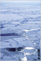
Climate change is not new. Since the first wind blew on the ancient Earth, natural climate variations have produced everything from ice ages and interglacial periods to flooding and drought, sunny days and hurricanes.
Since about 1870, when the U.S. secretary of war established what is now the National Oceanic and Atmospheric Administration’s National Weather Service “for giving notice ... on the seacoast by magnetic telegraph and marine signals of the approach and force of storms,” people have gotten some warning of sunny days, hurricanes and floods.
In 2006, when the National Integrated Drought Information System (NIDIS) Act was signed into law, it became easier to warn farmers, wildlife ecologists, water resource managers and local officials about impending droughts.
Today, NIDIS is an interagency and interstate coordination program to improve public awareness of drought and its effects, improve the capacities of counties and watershed organizations to reduce drought risks, and help fill information gaps such as those for drought monitoring and forecasting and assessing impacts.
“NIDIS begins by coordinating existing information on the impact of drought, and drought as affected by climate change and variability, into one framework ― that of an early warning information system,” NIDIS Director Roger Pulwarty told America.gov.
Early warning involves forecasts based on climate projections and the area’s drought history, possible outcomes of developing drought events, and answering questions about how long a drought might last and how severe it might be.
INTEGRATED SYSTEM
NIDIS links not only the results of technology — Earth observations, computer modeling and research — but the broad range of interested parties involved in drought planning and response.
“Now more than ever there is a need for us to have a way to provide data, information and decision-support tools at all scales of resolution ― local, regional, national and international,” Margaret Davidson, director of NOAA’s Coastal Services Center, told America.gov.
“This requires cooperation,” she said, “from collecting data through observing systems to developing standards for modeling work at these scales to training and information programs. The challenge is for folks to work across these scales.”

Federal agencies involved with NIDIS are NOAA, NASA, the U.S. Geological Survey, the U.S. Army Corps of Engineers, the Department of the Interior, the U.S. Department of Agriculture and others.
Also involved are regional, local, tribal and private entities, including the Western Governors Association, state climatologists, university agricultural extension offices, tribal water councils, nongovernmental organization representatives and local utilities.
The Western Governors Association drove the establishment of NIDIS, Pulwarty said, deciding that the country “needed one place we could go to for authoritative, credible, timely and usable information. They wanted to create a national entity to highlight and coordinate monitoring, forecasting and drought planning and preparedness.”
TIME SCALES AND APPROACHES
Some droughts last a single season and affect small areas. But the paleoclimate record shows that, like climate change itself, some droughts have continued for decades and affected millions of square kilometers.
NIDIS approaches early warning across all climate time scales and through five areas — monitoring and forecasting, communication and outreach, engaging preparedness communities, interdisciplinary research and applications, and a Web-based portal (drought.gov) that is a clearinghouse for all the NIDIS information.
“The working relationship among people is probably the most critical thing in the design of NIDIS,” Pulwarty said. “When we work in an area, we create a team of local people for those five groups.”
For the interdisciplinary research and applications piece, NIDIS uses another NOAA effort, the university-based regional integrated sciences and assessments (RISA) program. There are nine RISA centers around the country.
Through the RISAs, Pulwarty said, “we support research that focuses on projections of how climate events affect economic, environmental and cultural resources. The RISAs are broader than just drought, but drought is one of the things they do applied research on. We make sure that research can be fit into the early warning framework.”
Pulwarty and colleagues involved in NIDIS are advising officials from India about establishing that country’s own drought early warning system. NIDIS also has been approached by interested water resource officials from Australia and the Mediterranean and Caribbean regions.
Edward Miles and colleagues, in a 2006 Proceedings of the National Academy of Sciences study called “An Approach to Designing a National Climate Service,” described NIDIS as a “first step” in the development of a U.S. National Climate Service. (See “Knowledge Centers Could Help Regions Cope with Climate Change.”)
See also “Obama Makes Climate Change a National Priority.”
More information on NIDIS is available at drought.gov.
More information on the Coastal Services Center is available at the NOAA Web site.
