|
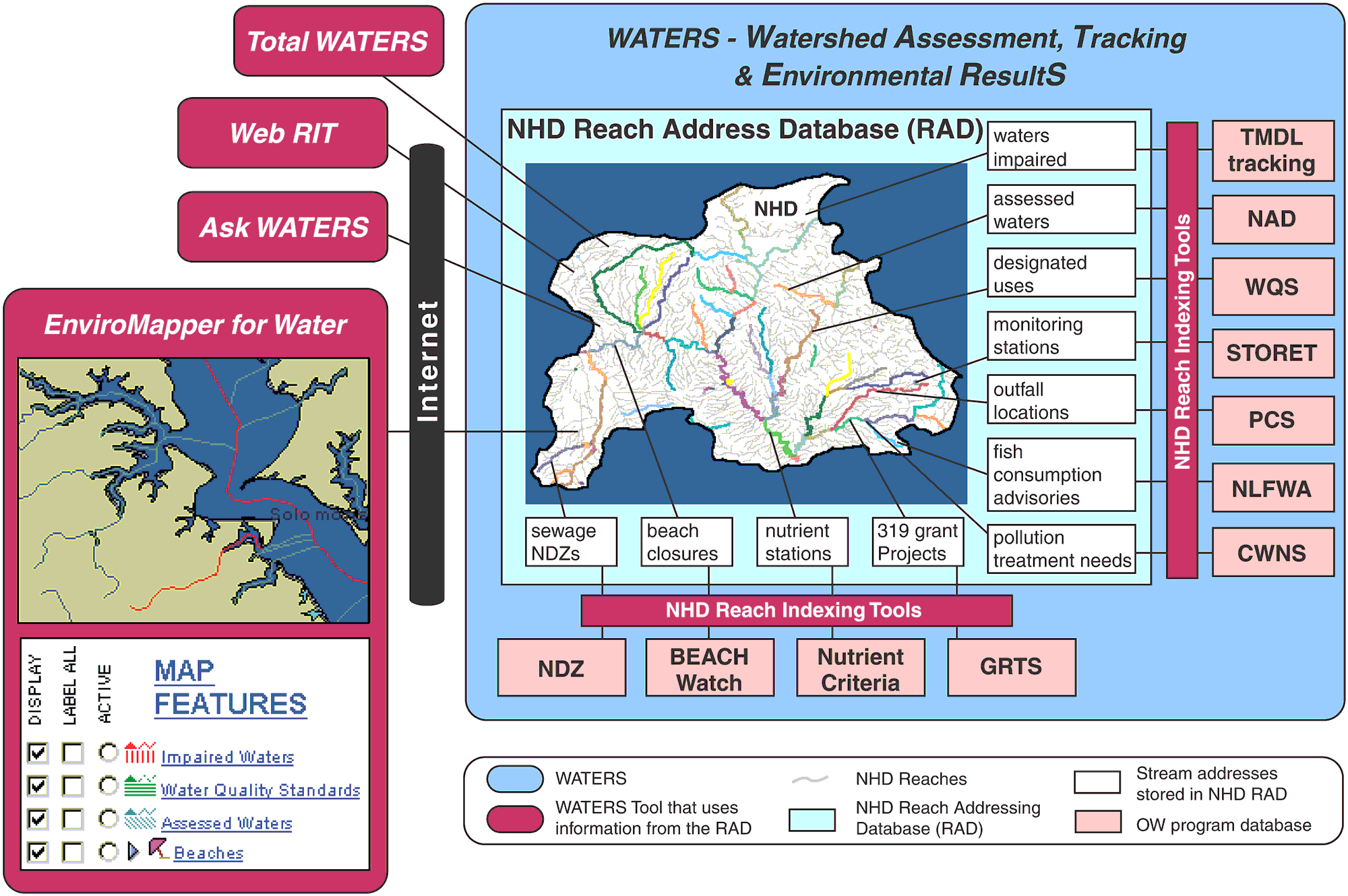
Watershed Assessment, Tracking & Environmental
ResultS (WATERS) consists of four major components as shown in the
figure above:
- National
Hydrography Dataset (NHD)
 - The National Hydrography Dataset is a
comprehensive set of digital geospatial data that contains information
about surfacewater features. The NHD includes an addressing system for
linking EPA Water Program data to the underlying NHD surfacewater
drainage network in order to facilitate its geographic integration,
analysis and display. - The National Hydrography Dataset is a
comprehensive set of digital geospatial data that contains information
about surfacewater features. The NHD includes an addressing system for
linking EPA Water Program data to the underlying NHD surfacewater
drainage network in order to facilitate its geographic integration,
analysis and display.
- Reach
Address
Database (RAD) - The Reach Address Database stores the reach
address for each Water Program feature that has been linked to the NHD.
These reach addresses record the geographic extent of Water Program
features in both tabular and spatial formats. The reach addresses link
to a static copy of the NHD obtained from the USGS, which also resides
in the RAD.
- Water
Program databases - The EPA Office of Water has numerous
programs that collect and store water related information in separate
databases. By linking the features stored in these Water Program
databases to the NHD, the collective information held within the
databases can be shared across programs to better facilitate water
quality management.
- WATERS
Tools - Tools and applications that generate and use the reach
addresses in the RAD to query, analize and display information across
Water Programs. The process of assigning NHD reach addresses to Water
Program features is often referred to as reach indexing and the
tools that support this assignment as reach indexing tools (RIT).
Learn more about how Water Program features are linked, or georeferenced, to the Reach Address
Database. |