Local forecast by
"City, St" or zip code |
|
|
|
|
Back to
Home
Page
October 2003
Storm of the Month October produced a
few strong to severe storms toward the end of the month that were noteworthy, mainly on the
25th. The images below were taken at 434 pm cdt as a storm roared across
Sunflower county in the Delta, about 80 statute miles northwest of the
radar. This storm peaked with a vertical core of
50-55dBz returns
that reached 33,000 feet and had returns of 71dBz as high as 17,000
feet. The VIL topped out near 60kg/m*m with hail
algorithms at 2.00" diameter hail. Some storm rotation was also noted and several power poles were knocked down in
southern Sunflower County. The storm weakened somewhat downstream as
it crossed Greenwood but still managed to produce golf ball sized hail
there.
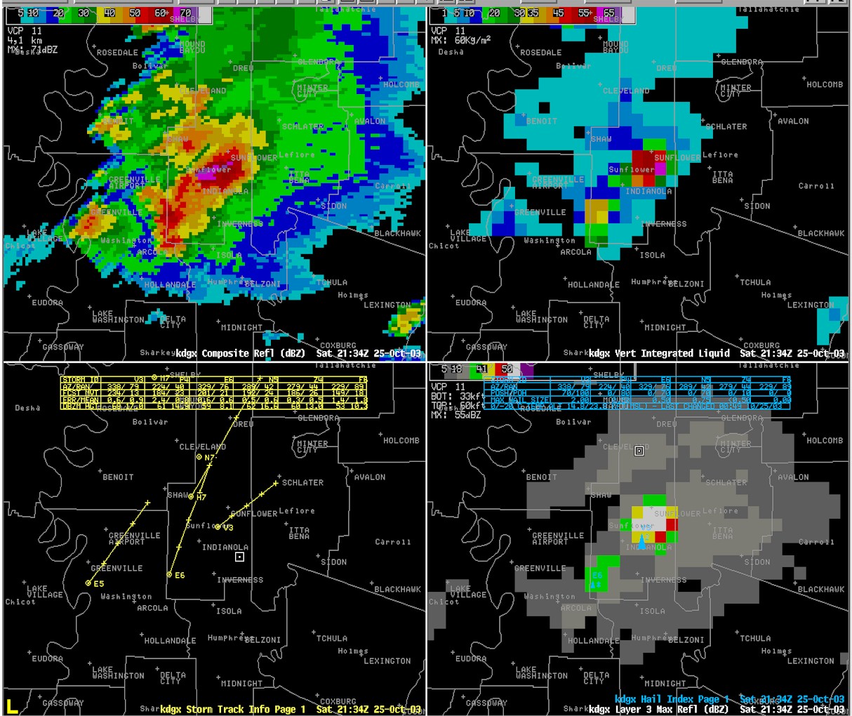 |
A 4 Panel of Composite Reflectivity, VIL, Storm Tracks, and High Level(>33k ft)
Reflectivity at 434 pm cdt
 A 4 Panel of Reflectivity Elevation cuts(0.5, 1.5, 2.4, 3.5 slices) at 434 pm cdt
 |
 |
Corresponding image of Lowest 4 elevation cuts of Storm Relative Velocity at 434 pm
Return to Storm of the Month Index Page
|
|


