Local forecast by
"City, St" or zip code |
|
|
|
|
Back to
Home
Page
June 2003
Storm of the Month
June produced several rounds of impressive storms with flooding, hail and
weak tornadoes on the 2nd, 5th, 7th, and the 17th. As far as radar
imagery, our winner from the KDGX radar in Brandon came on the afternoon of the
2nd. A complex of supercells moved northeast at 15 knots through east Mississippi
across Lowndes county between 5 and 6 p cdt. The most
intense storm developed across the Alabama border in Pickens county when
the images below which were taken at 532 pm. Even at 123nm from the
radar, this storm showed a vertical core of 55dBz returns
that reached 42,000 feet(lower right image in the 4 panel view below) and resulted in a VIL of 77kg/m*m.
The KDGX hail
algorithms topped at 2.00" hail(hen egg size)
as seen in the table data. Echo Tops were close to 55,000 feet
Meanwhile at nearly the same time, a band of severe storms was knocking
trees down just a few miles west of the radar in the Jackson metro area.
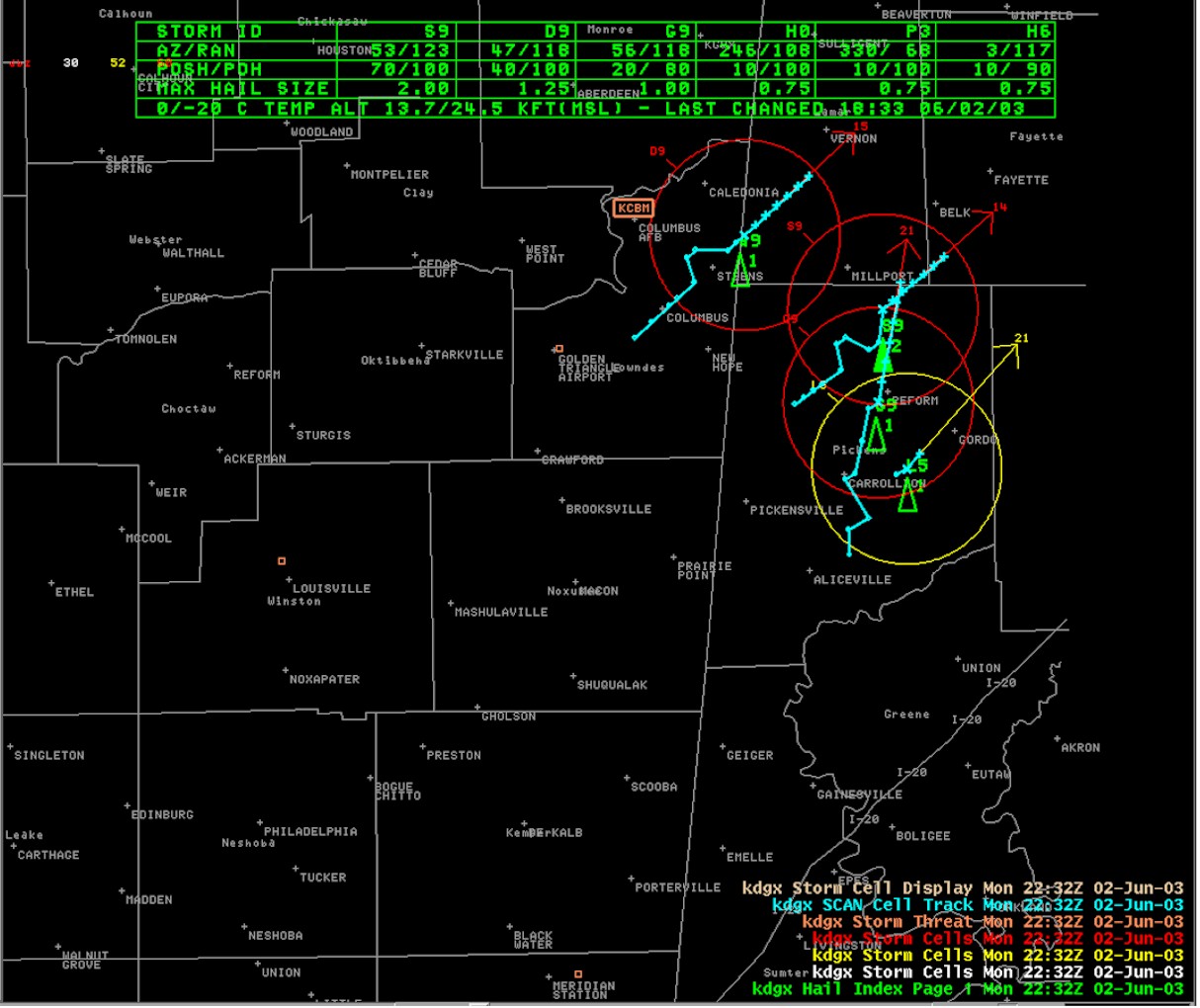 |
SCAN storm imagery for Cell S9 at 532 pm cdt
 |
Composite Reflectivity with attribute table at 532 pm cdt
 |
A 4 Panel of lowest 4 Elevation cuts(0.5, 1.5, 2.4, 3.4 slices) at 532 pm cdt
Return to Storm of the Month Index Page
|
|