


| Print Page | |||||||||||||||
|
Vermilion Cliffs National Monument Paria Canyon/Vermilion Cliffs Wilderness Coyote Buttes Permit Area - Trailheads & Access Points |
|||||||||||||||
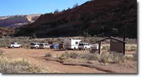
The Notch Access PointThe Notch is an undeveloped access point that provides entry to Coyote Buttes North. There is limited parking available. It is not signed. Please park in existing disturbed areas only. From Page, AZ, drive west on Highway 89 for 34 miles (55 kilometers). Drive past the BLM Ranger Station and the road to the White House trailhead. Turn left onto House Rock Valley Road. This road is compacted dirt. The Notch access point is 9.6 miles (15.4 kilometers) down this dirt road, just past Stateline Campground. From Kanab, UT, drive east on Highway 89 for 38 miles (61 kilometers). Turn right onto House Rock Valley Road. This road is compacted dirt. The Notch access point is 9.6 miles (15.4 kilometers) down this dirt road, just past Stateline Campground. Hiking and Camping Information
Lone Tree Access PointThe Lone Tree is an undeveloped access point that provides entry to Coyote Buttes South. There is limited parking available. It is not signed. Please park in existing disturbed areas only. From Page, AZ, drive west on Highway 89 for 34 miles (55 kilometers). Drive past the BLM Ranger Station and the road to the White House trailhead. Turn left onto House Rock Valley Road. This road is compacted dirt. Drive 16.0 miles (25.75 kilometers) down this road. Turn left (east) on a narrow dirt track and drive 0.25 miles (0.4 kilometers) and park near a lone tree next to a small reservoir. From Kanab, UT, drive east on Highway 89 for 38 miles (61 kilometers). Turn right onto House Rock Valley Road. This road is compacted dirt. Drive 16.0 miles (25.75 kilometers) down this road. Turn left (east) on a narrow dirt track and drive 0.25 miles (0.4 kilometers) and park near a lone tree next to a small reservoir. Hiking and Camping Information
Paw Hole Access PointVisiting the Paw Hole access point requires backcountry navigation and driving skills. Four-wheel drive is mandatory, as are topographic maps. Please stop by the Paria Ranger Station or the Kanab Field Office for maps, road conditions and navigation advice. The Paw Hole is an undeveloped access point with parking available. It is not signed. Please park in existing disturbed areas only. Hiking and Camping Information
Cottonwood Cove Access PointVisiting the Cottonwood Cove access point requires backcountry navigation and driving skills. Four-wheel drive is mandatory, as are topographic maps. Please stop by the Paria Ranger Station or the Kanab Field Office for maps, road conditions and navigation advice. Cottonwood Cove is an undeveloped access point that provides entry to Coyote Buttes South. There is limited parking available. It is not signed. Please park in existing disturbed areas only. Hiking and Camping Information
|
|||||||||||||||
 From Page, AZ, drive west on Highway 89 for 34 miles (55 kilometers). Drive past the BLM Ranger Station and the road to the White House trailhead. Turn left onto House Rock Valley Road. This road is compacted dirt. The Wire Pass trailhead is 8.3 miles (13.4 kilometers) down this dirt road.