Current Conditions and Observations
Surface
|
Upper Air
|
Marine
|
Precipitation
|
Snow
UV Index
|
Satellite & Radar
Nationwide Road Reports
|
Web Cams
|
XML/RSS feeds
|
CoCoRaHS
Click on an observation site to view current conditions
Surface Observations
MesoWest
-
What is MesoWest?
Regional Weather Round-Up
NJ Weather and Climate Network (NJWxNet)
Delaware Environmental Observing System
State MAX/MIN temperature and precipitation table
Regional Surface Plot
National Surface Plot
(experimental from FSL)
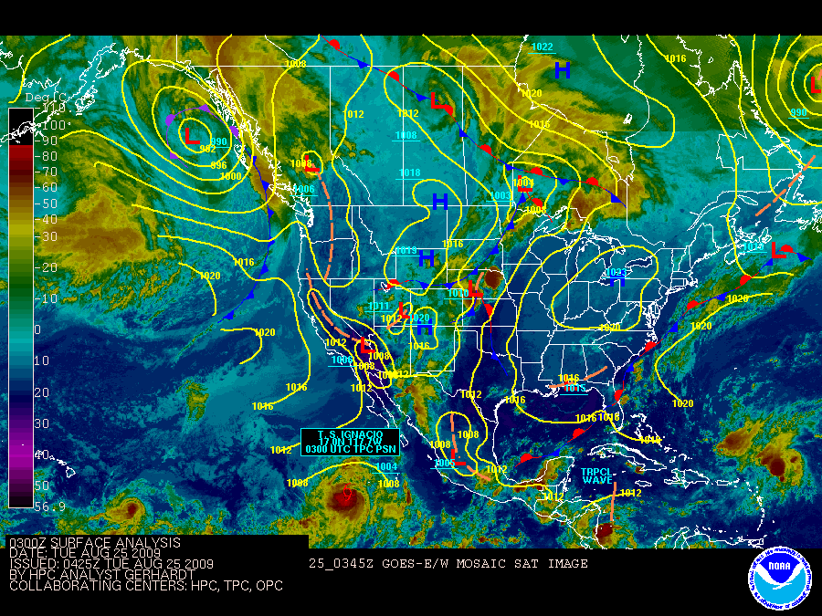
Current Surface Analysis
(MSLP/Fronts/Satellite)
Northeast U.S. Surface Streamline Analysis
Standard Hydrometeorological Exchange Format (SHEF) Manual
Mean Sea Level Pressure (MSLP) Analysis:
U.S. Wind Speed/MSLP Analysis
Northeast U.S. MSLP Analysis
Temperature Analysis:
U.S. Temperature Analysis
Northeast U.S. Temperature Analysis
Moisture Analysis:
U.S. Dew Point Analysis
Northeast U.S. Relative Humidity Analysis
Upper Air Observations
Nationwide Skew-T/Log-P Diagrams
Satellite Soundings
Heights/Temperatures at:
850 mb
700 mb
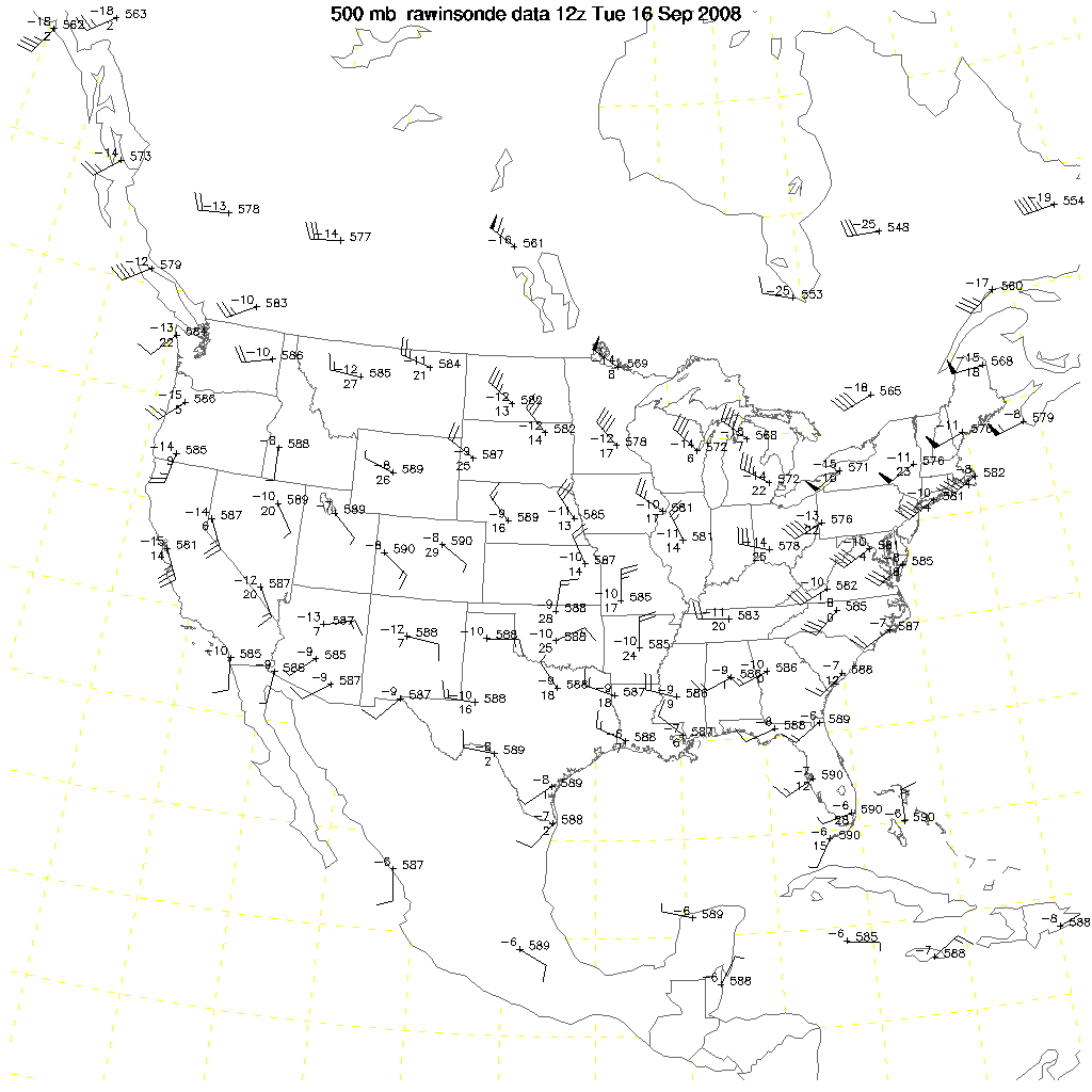
500 mb
300 mb
250 mb
200 mb
Marine Observations
nowCOAST (NJ/NY waters)
Buoy Observations
Coastal Observations
Cape May-Lewes Ferry & Ship Bottom, NJ Observations
Rutgers University Coastal Ocean Observation Lab
Davidson Laboratory Coastal Monitoring Network
(from Stevens Institute of Technology)
Naval Atlantic Meteorology and Oceanography Center
Tide and Meteorology Data for Selected Ports
NODC Ocean Temperatures
Local River and Coastal Water Temperatures
Sea Surface Temperature Imagery
Precipitation Data
Automated Rainfall Data (IFLOWS):
Maryland
New Jersey
Pennsylvania
Northeast U.S.
State MAX/MIN temperature and precipitation table
U.S. 24-hour Precipitation Amount
Radar Estimated Precipitation is available on our radar web site:
KDIX
: Mount Holly, NJ
KDOX
: Dover AFB, DE
Snow Cover and Depth
U.S. Snow Monitoring; Recent Snowfall and Snowdepth Maps
Current observations: Daily Snowfall and Snow Depth Maps
National Snow Summary
Snow Water Equivalent and Snow Depth Maps
Storm Archives
Ultraviolet Index
IWIN UV Index
UV Safety Recommendation Chart
Satellite & Radar Imagery
Images from GOES-12 and GOES-10 satellites
Geostationary Satellite Server
National Weather Service Philadelphia/Mount Holly Doppler Radar
Web Cams
Delaware Department of Transportation
New Jersey Department of Transportation
New York City Department of Transportation
Pennsylvania Department of Transportation
Doylestown, PA Airport (KDYL)
is a
NWS ASOS
site. The official NWS report on current weather conditions for this location can be viewed
here
.
XML Data and RSS Feeds
Delaware
Maryland
New Jersey
New York
Pennsylvania


