Skip Navigation
NOAA
weather.gov
National Weather Service Weather Forecast Office
Denver/Boulder, CO
Search for:
NWS
All NOAA
Home
Site Map
News
Organization
Local forecast by
"City, St" or Zip Code
Current Hazards
Watches / Warnings
Outlooks
U.S. Hazards
Hurricane Info
Colorado Watches
About Lightning
Spotter Program
Submit Storm Report
Severe WX Page
Winter Hazards
Current Conditions
Rivers & Lakes AHPS
Precip Estimate
Snow Cover
Current Weather
Pressure Data
World WX Conditions
Temp/Moisture Data
Weather Maps
Interactive WX Net
Radar Imagery
Local Radar
Nationwide
Forecasts
Activity Planner
Local Area
Aviation
Fire Weather
Graphical
Interactive
Zone Forecast
Soaring Forecast
Activity Planner
UV Index Today
Forecast Recordings
Rivers / Hydrology
AHPS / River Info
Flash Floods
Hydrologic Outlook
Hydro Precip Maps
Hydrology Links
Coop Program
Coop Precipitation
Climate
Local
National
More...
Weather Safety
StormReady
Preparedness
Weather Radio
EMWIN
General Info Links
Educate
WX Website For Kids
Local Information
Storm Archive Info
News Story Archives
Denver Office History
Contact Us
Webmaster
Feedback
Map of NWS Offices
Top News of the Day
A Soggy Look Back At Denver's April 2009
2009 Spotter Talk Schedule
Live Colorado River Basin Water Supply Briefing May 7th
Live Colorado River Basin Peak Flow Forecast Briefing May 12th
Watches &
Warnings
Observations
Forecast Graphics
Rivers &
Lakes
Climate
Other Forecasts
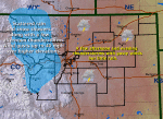
Click on the map below for the latest forecast.
Last map update: Tue, May. 5, 2009 at 5:03:17 pm MDT
Read watches, warnings & advisories
Zoom
Out
Special Weather Statement
Hazardous Weather Outlook
Short Term Forecast
Latest Conditions in
Denver International Airport, CO
Choose Your Front Page City
May 5
3:53 pm
Mostly Cloudy
71°F
(22°C)
Select A City:
Akron, CO
Buckley AFB, CO
Centennial Airport, CO
Copper Mountain, CO
Denver International Airport, CO
Fort Collins/Loveland Airport, CO
Grand Junction, CO
Greeley, CO
Jefferson County Airport, CO
Kremmling, CO
Limon, CO
Monument, CO
Pueblo, CO
Wilkerson Pass, CO
Weather Story
Radar
Satellite
Weather Map
"
Serving Northeastern and
North Central Colorado
"
Quick Access to Text Products
Area Forecast Discussion
Area Forecast Product
Civil Emergency Message
Climate Summary
Earthquake Report
Fire Weather Forecast
Flash Flood Statement
Flash Flood Warning
Flood Statement
Flood Watch
Flood Warning
Hazardous Weather Outlook
Hydrologic Outlook
Hydrologic Statement
Hydrologic Summary
Local Storm Report
Monthly Climate Summary
Monthly Hydrologic Summary
Non-Precipitation Products
Pollution Advisory
Public Information Statement
Record Event Report
Regional Temps and Precip
Severe Weather Statement
Severe Thunderstorm Warning
Short Term Forecast
Special Weather Statement
Tornado Warning
Winter Weather Products
Zone Forecast
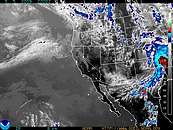
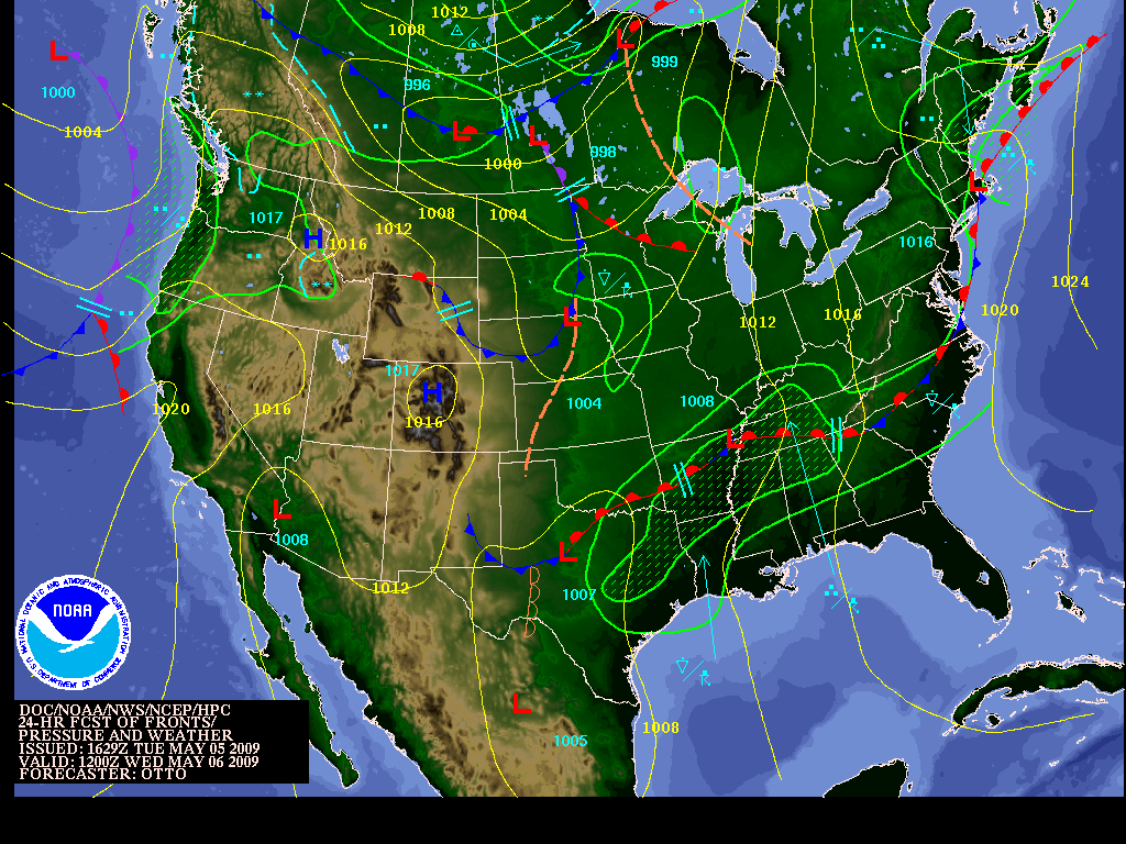
"Click on the thumbnails below to see a larger view of the requested image"
Latest Denver Radar
National NWS Weather Radar
Weather Story
24 Hour Forecast Map **
Latest Western U.S. Satellite
Latest Eastern U.S. Satellite
**
24HR Forecast map is generated daily between 9 and 11 AM MST.
National Weather Service
Denver/Boulder, CO Weather Forecast Office
325 Broadway
Boulder, CO 80305-3328
303-494-4221
Page Author: BOU Webmaster
Web Master's E-mail:
w-bou.webmaster@noaa.gov
Page last modified: 23-Aug-2007 2:18 PM UTC
Disclaimer
Credits
Glossary
Privacy Policy
About Us
Career Opportunities