|
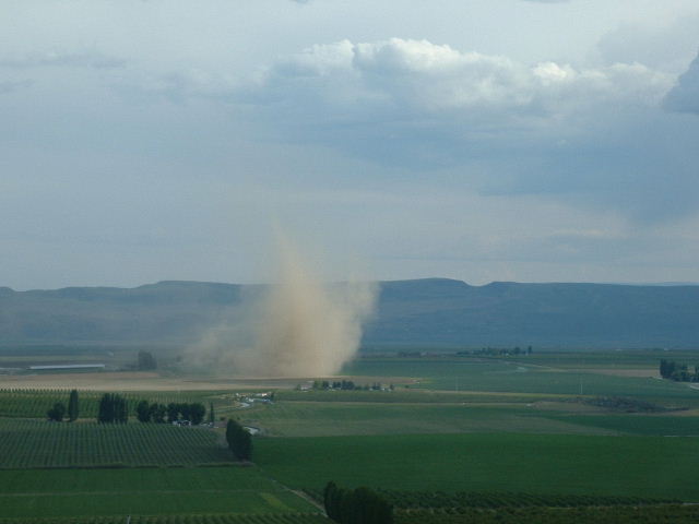
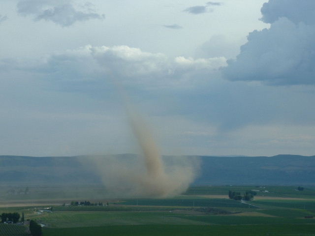
On
May 11th, 2003 a tornado developed in the fields near Warden, WA. The
photographer reported "I was about 2.5 miles north of the twister,
and it blew out a storage shed wall and
moved a water tank on the farm that was under it. At the same time,
I took a different picture of a funnel cloud (last picture below) that
was up in the clouds, above me. In talking to someone who saw it from
Othello, which is 15 miles to the east, I was told the twister later
leaned over sideways, and the bottom lifted up, and it was horizontal,
before receding back up into the clouds."
This
sequence of photos shows what could have been a "non-descending"
tornado. A ciruculation (such as a dust devil) originates at the surface.
Meanwhile air near the ground is being drawn into a cumulus cloud (in
this case, it wasn't even a thunderstorm). This is known as an updraft.
The updraft stretches the circulation, causing it to spin faster, much
like an ice skater increases her speed of rotation by drawing her arms
in. As the updraft continues, the circulation is drawn up into the sky.
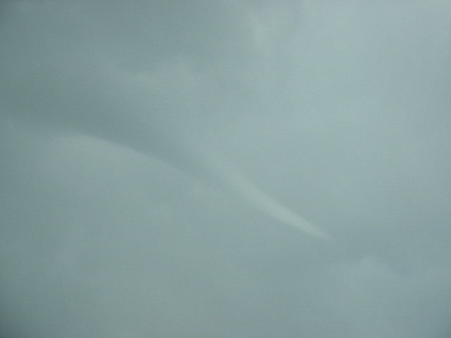
The
last photo shows a funnel cloud that is clearly originating from the
base of a cloud but not touching the ground. This funnel cloud was not
associated with the tornado, but it does indicate that the storms that
day did have the ability to produce funnels without having a surface
circulation. The picture above the funnel cloud image shows that the
tornado did not have any associated circulation in the clouds, which
again indicates that it may have been a non-descending tornado.
|