
ABOUT FISC
DATA CENTER
SCIENCE WEBSITES
OFFICES
FISC - Headquarters
12703 Research Parkway
Orlando, FL 32826
Tel: 407-803-5500
Fax: 407-803-5501
Orlando - 407-803-5500
Ft. Lauderdale - 954-377-5900
Ft. Myers - 239-275-8448
Tampa - 813-975-8620
Tallahassee - 850-553-3640
|
FISC - Water Resources
The mission of the Water Discipline, which supports the overall mission of the U.S. Department of the Interior and the U.S. Geological Survey, is to provide the hydrologic information and understanding needed for the best use and management of the Nation's water resources for the benefit of the people of the United States.
The USGS provides current ("real-time") stream stage and streamflow (566 sites), water-quality (157 sites), and ground-water levels for 222 sites in Florida.
Water Resources of the United States
USGS Florida Science Highlights
FISC-Tallahassee Crews Track Suwannee River Flood Crest
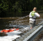 North Florida rivers began to swell in April from the runoff of heavy storms in Georgia, culminating in a record gage height on the Withlacoochee River and a record volume of water discharging down the Alapaha River. As the flood waters of these Suwannee River tributaries flowed into the main channel of the Suwannee, the dry floodplain absorbed much of the excess water, and flood crest levels gradually attenuated. At Ellaville, just below where the Withlacoochee comes into the Suwannee, the peak flow was the 4th highest on record. Downstream in Branford, it was the 7th highest on record. North Florida rivers began to swell in April from the runoff of heavy storms in Georgia, culminating in a record gage height on the Withlacoochee River and a record volume of water discharging down the Alapaha River. As the flood waters of these Suwannee River tributaries flowed into the main channel of the Suwannee, the dry floodplain absorbed much of the excess water, and flood crest levels gradually attenuated. At Ellaville, just below where the Withlacoochee comes into the Suwannee, the peak flow was the 4th highest on record. Downstream in Branford, it was the 7th highest on record.
FISC-Tallahassee crews measured the volume of water and height of the river at the flood's peak or near-peak levels, providing critical daily updates to the National Weather Service, Southeast Region River Forecast Center, and Suwannee River Water Management District.  USGS News Release USGS News Release
Hydrologic Conditions in Florida during Water Year 2007
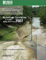
Scientific Investigations Report 2008-5221. Record-high and record-low hydrologic conditions occurred during water year 2007 (October 1, 2006 - September 30, 2007) based on analyses of precipitation, surface-water flows, lake elevations, and ground-water levels. For example, the streamgage at Suwannee River at White Springs in northwest Florida recorded an annual streamflow of 103 cubic feet per second during 2007, or about 6 percent of the period-of-record average since monitoring began in 1906. Lake Okeechobee in south Florida reached record-low elevations (8.82 feet on July 2) since monitoring began in 1912. Several wells throughout the State registered period-of-record lowest daily maximum water levels.
Find out more
Comparative Hydrology, Water Quality, and Ecology of Selected Natural and Augmented Freshwater Wetlands in West-Central Florida
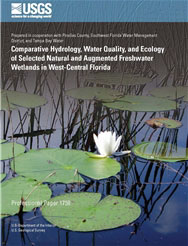
Professional Paper 1758. Comparing altered wetlands to natural wetlands in the same region improves the ability to interpret the gradual and cumulative effects of human development on freshwater wetlands. Hydrologic differences require explicit attention because they affect nearly all wetland functions and are an overriding influence on other comparisons involving wetland water quality and ecology. This study adopts several new approaches to quantify wetland hydrologic characteristics and then describes and compares the hydrology, water quality, and ecology of 10 isolated freshwater marsh and cypress wetlands in the mantled karst landscape of central Florida.
Find out more
Of Current Interest
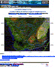 USGS South Florida Coastal Stations.
The U.S. Geological Survey Florida Integrated Science Center, located in Fort Lauderdale, Florida and includes Fort Myers, Florida operates and maintains an integrated coastal monitoring network of surface water, ground water, water quality, wind, and rainfall monitoring stations throughout south Florida. The real-time clickable map allows scientists, resource managers, and the public access to provisional and published data provided on the National Water Information System (NWIS). The real-time map is a combination of projects funded by the Greater Everglades Science Program: USGS South Florida Coastal Stations.
The U.S. Geological Survey Florida Integrated Science Center, located in Fort Lauderdale, Florida and includes Fort Myers, Florida operates and maintains an integrated coastal monitoring network of surface water, ground water, water quality, wind, and rainfall monitoring stations throughout south Florida. The real-time clickable map allows scientists, resource managers, and the public access to provisional and published data provided on the National Water Information System (NWIS). The real-time map is a combination of projects funded by the Greater Everglades Science Program:
Recent Publications
 Fact Sheet 2008-3035 German. E.R., 2008, Volusia Blue Spring--A Hydrological Treasure: U.S. Geological Survey Fact Sheet 2008-3035, 6 p. Fact Sheet 2008-3035 German. E.R., 2008, Volusia Blue Spring--A Hydrological Treasure: U.S. Geological Survey Fact Sheet 2008-3035, 6 p.
|
 Fact Sheet 2008–3080 Richard L. Marella, Water Use in Florida, 2005 and Trends 1950–2005. Fact Sheet 2008–3080 Richard L. Marella, Water Use in Florida, 2005 and Trends 1950–2005.
|
Open-File Report 2008-1364 Reich, C.D., Swarzenski, P.W., Greenwood, J.W., and Wiese, D.S., 2009, Investigation of coastal hydrogeology utilizing geophysical and geochemical tools along the Broward County coast, Florida: U.S. Geological Survey Open-File Report 2008-1364, 21 p., plus apps. A-C. |
Scientific Investigations Map 3057 Ortiz, A.G., 2008, Potentiometric surface of the Upper Floridan aquifer, west-central Florida, May 2008: U.S. Geological Survey Scientific Investigations Map 3057, 1 sheet. |
 Scientific Investigations Report 2007-5217 Byrne, M.J., Gabaldon, J.N., 2008, Hydrodynamic Characteristics and Salinity Patterns in Estero Bay, Lee County, Florida: U.S. Geological Survey Scientific Investigations Report 2007-5217, 33 p. Scientific Investigations Report 2007-5217 Byrne, M.J., Gabaldon, J.N., 2008, Hydrodynamic Characteristics and Salinity Patterns in Estero Bay, Lee County, Florida: U.S. Geological Survey Scientific Investigations Report 2007-5217, 33 p.
|
 Scientific Investigations Report 2007-5238 Kroening, S.E., 2008, Assessment of Water-Quality Monitoring and a Proposed Water-Quality Monitoring Network for the Mosquito Lagoon Basin, East-Central Florida: U.S. Geological Survey Scientific Investigations Report 2007-5238, 53 p. Scientific Investigations Report 2007-5238 Kroening, S.E., 2008, Assessment of Water-Quality Monitoring and a Proposed Water-Quality Monitoring Network for the Mosquito Lagoon Basin, East-Central Florida: U.S. Geological Survey Scientific Investigations Report 2007-5238, 53 p.
|
 Scientific Investigations Report 2008-5062 Darst, M.R., Light, H.M., 2008, Drier Forest Composition Associated with Hydrologic Change in the Apalachicola River Floodplain, Florida: U.S. Geological Survey Scientific Investigations Report 2008-5062, 81 p., plus 12 apps. Scientific Investigations Report 2008-5062 Darst, M.R., Light, H.M., 2008, Drier Forest Composition Associated with Hydrologic Change in the Apalachicola River Floodplain, Florida: U.S. Geological Survey Scientific Investigations Report 2008-5062, 81 p., plus 12 apps.
|
 Scientific Investigations Report 2007-5207 Reese, R.S., and Richardson, Emily, 2008, Synthesis of the Hydrogeologic Framework of the Floridan Aquifer System and Delineation of a Major Avon Park Permeable Zone in Central and Southern Florida: U.S. Geological Survey Scientific Investigations Report 2007-5207, 60 p., 4 pls., plus apps. Scientific Investigations Report 2007-5207 Reese, R.S., and Richardson, Emily, 2008, Synthesis of the Hydrogeologic Framework of the Floridan Aquifer System and Delineation of a Major Avon Park Permeable Zone in Central and Southern Florida: U.S. Geological Survey Scientific Investigations Report 2007-5207, 60 p., 4 pls., plus apps.
|
 Scientific Investigations Report 2007-5277 Miller, R.L., and McPherson, B.F., 2008, Water Quality in the Arthur R. Marshall Loxahatchee National Wildlife Refuge—Trends and Spatial Characteristics of Selected Constituents, 1974-2004: U.S. Geological Survey Scientific Investigations Report 2007-5277, 34 p. Scientific Investigations Report 2007-5277 Miller, R.L., and McPherson, B.F., 2008, Water Quality in the Arthur R. Marshall Loxahatchee National Wildlife Refuge—Trends and Spatial Characteristics of Selected Constituents, 1974-2004: U.S. Geological Survey Scientific Investigations Report 2007-5277, 34 p.
|
View Our Most Recent Publications
Florida Weather
|


