 |
A
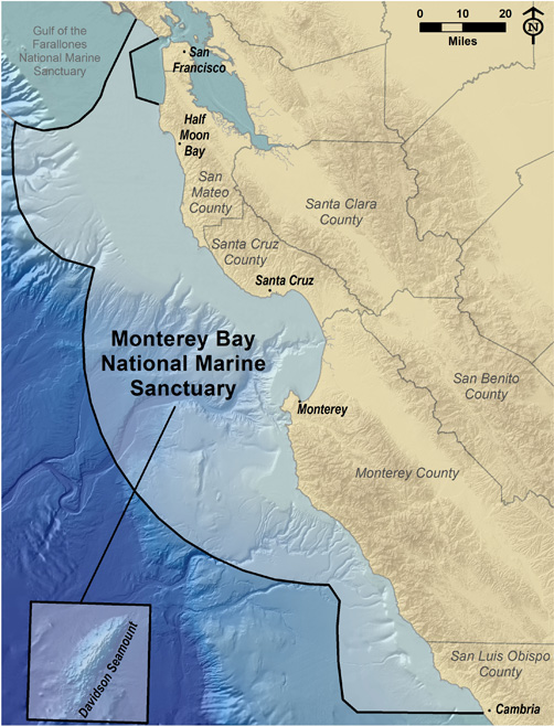
map of the Monterey Bay National Marine Sanctuary, featuring
never before seen bathymetric and topographical information,
is now available. The spectacular image is ideal for education
purposes, map lovers and anyone that appreciates beautiful
art. You can order a 24"x36" copy of this map from
the Sanctuary
Foundation ($14.95)
The
graphic below is provided courtsey of the Monterey Bay National
Marine Sanctuary Foundation for your personal and educational
use.
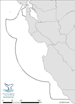
Map
Image (600x769; 160KB jpeg) |
 |
MBNMS Map - Color
MBNMS color map including bathymetry and hillshade.
Map Image (479 x 658; 160KB jpeg) |
 |
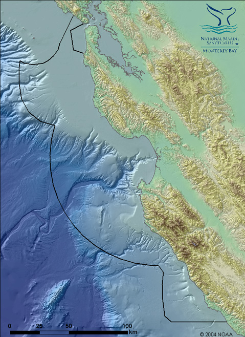
MBNMS Map - Color
MBNMS boundary map including bathymetry, hilshade and Davidson Sea Mount
Map Image (502 x 658; 144KB jpeg) |
 |
MBNMS Map - Black & White
MBNMS black and white map without text. Boundary and watersheds only.
Map Image (479 x 658; 60KB png) |
 |
Critical Coastal Areas
The Critical Coastal Areas (CCA) Program fosters collaboration among local stakeholders and government agencies, to better coordinate resources and focus efforts on coastal watersheds in critical need of protection from polluted runoff. Please visit the following web page for more information.
Map Image (1.3 MB PDF) |
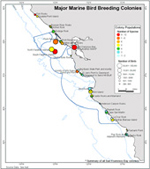 |
NOAA's Northern and Central California Biogeographic Assessment
Access over one hundred maps showing densities and common locations of many animals, from seabirds to blue whales |
 |
SIMoN Interactive Map
Three differently-themed interactive maps. Customize and print your own map |
 |
Overflight Map
GIS map illustrating the four zones with overflight restrictions. Please visit the following web page for more information.
Map Image (600 x 744; 148KB jpg) |
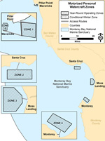 |
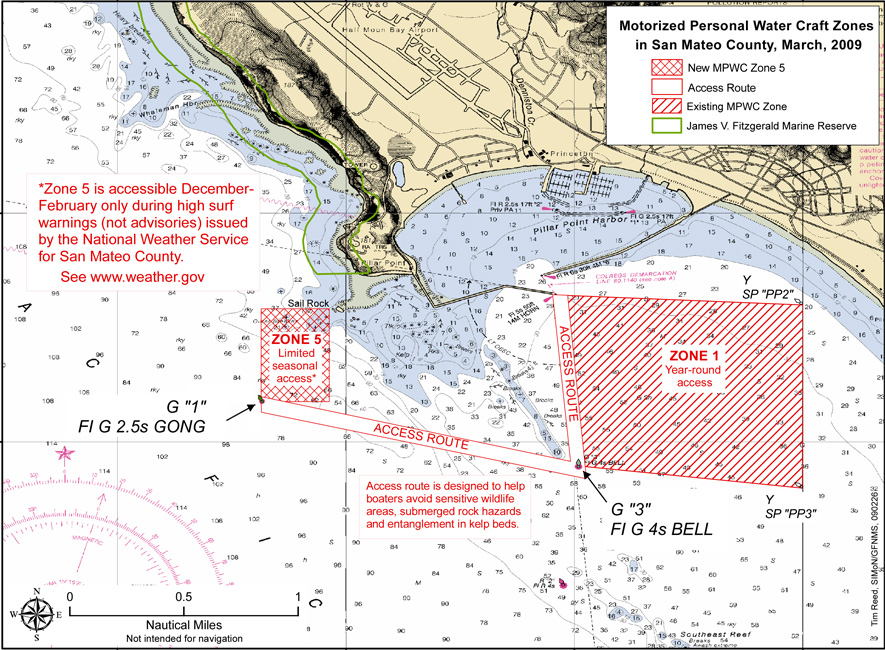
Motorized Personal Watercraft Use Map
Motorized Personal Watercraft use zones. Map showing the four designated zones and access routes within the Sanctuary, with overlay of pinniped haul-out and seabird nesting areas. Please visit the following web page for more information.
Map Image (600 x 805; 160KB jpg) |
 |
Motorized Personal Watercraft Use Map - Zone 5
Map Image (883 x 650; 220KB jpeg) |
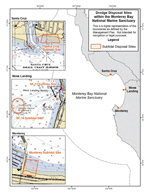 |
Dredging Map
Dredging sites for the four harbors in the MBNMS including Pillar Point, Moss Landing, Santa Cruz and Monterey harbors. Please visit the following web page for more information.
Map Image (600 x 744; 180KB jpg) |
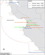 |
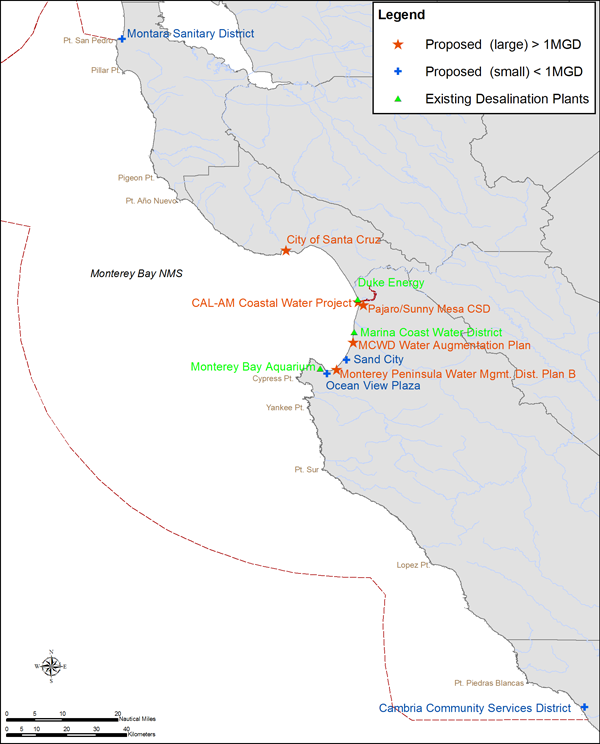
Desalination Map
Existing and potential desalination plants in the Monterey Bay National Marine Sanctuary. Please visit the following web page for more information.
Map Image (600 x 744; 172KB png) |
 |
Elkorn Slough Map
The main channels of the Elkhorn Slough fall under the Monterey Bay National Marine Sanctuary jurisdiction. The surrounding marsh areas are under the Elkhorn Slough National Estuarine Research Reserve jurisdiction.
Map Image (600 x 792; 188KB jpg) |
 |
11
Watersheds in the MBNMS Region
The Monterey Bay National Marine Sanctuary receives runoff from watersheds that cover an extensive area. Please visit the following web page for more information.
Map
Image (900 x 1165; 130KB
jpg) |
 |
Recommended
Ship Tracks
Effective and safe vessel traffic management within the Monterey Bay National Marine Sanctuary is ensured by vessels following these tracks. Please visit the following web page for more information.
Map
Image (900 x 1282; 130KB
jpg) |
 |
ASBS
Sites in the MBNMS Region
Areas of Special Biological Significance are a subset of state water quality protection areas that protect resources from an undesirable alteration in natural water quality. Please visit the following web page for more information.
Map
Image (900 x 1165; 90KB
jpg) |
 |
ONMS
Satellite Map
Satellite based map of all of the National Marine Sanctuaries and the National Marine Monument in the United States. Please visit the following web page for more information.
Map
Image (900 x 650;
70KB jpg) |
 |
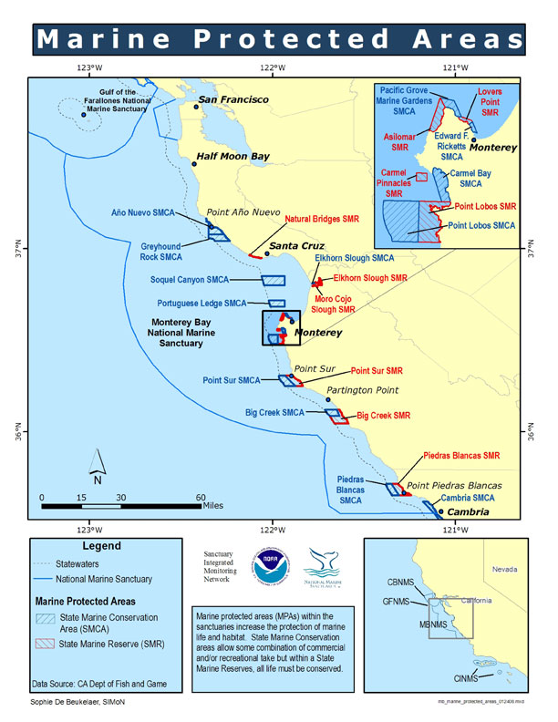
Marine Protected Areas Map
In 2007, 23 new marine protected areas were established within the Monterey Bay National Marine Sanctuaries' state waters. Please visit the following web page for more information.
Map
Image (612 x 792; 112KB jpg) |
 |
Groundfish Closure Areas Map
Groundfish closed areas specific to particular gear types transect the Monterey Bay National Marine Sanctuary. Please visit the following web page for more information.
Map
Image (612 x 792; 118KB jpg) |
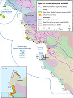 |
Map of Special Areas within the MBNMS
The Critical Coastal Areas (CCA) Program fosters collaboration among local stakeholders and government agencies, to better coordinate resources and focus efforts on coastal watersheds in critical need of protection from polluted runoff. Please visit the following web page for more information.
Map Image (574 x 765; 172KB jpg |


