Local forecast by
"City, St" or zip code |
|
|
You are at: NWS �
NWS SRH �
NWS Jackson � Sunflower Hail
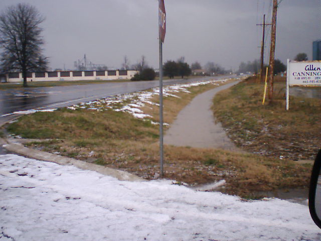
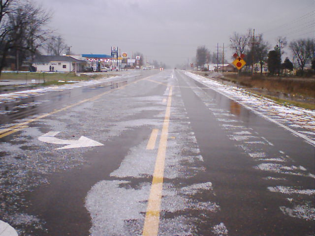
Looks Like Snow
In Sunflower County!
Although this may look like snow on the ground, it's really hail!
A little after 9 AM on Wed, Feb 23, a Severe Thunderstorm warning was issued for Sunflower
County with the primary threat being hail.
Shortly after issuing the warning, several calls came into the office
reporting hail around the Drew area. Sizes ranged from nickel to quarter
size hail with the largest being an inch. Some stated that there was
a blanket of hail on the ground as evidenced by the photos below.
The "hail storm" lasted for approximately 15 minutes and then moved out of the county.
Click on the images below to see a larger version.
|
 |
 |
 |
 |
 |
 |
 |
 |
 |
 |
|
 |
Photos Courtesy of Sunflower County Emergency Management.
|